
Mike Pemberton
April 29, 2017

Four teammates met the evening of April 28 at the north end of the Pigeon River State Forest about 20 miles north of Gaylord MI. Spock, Hot Pockets, AquaPhoenix, and Kirsten assembled. There is a spot down a two-track that dead ends at the shore of the Pigeon River and has about 20 old-growth pine trees among the quiet forest. It is the perfect spot to unwind.
As we got settled and did some introductions the excitement grew as we knew the day ahead had an ambitious goal. We chose a spot well to our south to camp the second night and prepared to travel there by mountain bike. We wanted to place a Fortune Bay Guild Member Navigation Challenge there and explore a stretch of the Sturgeon River that includes a confluence and is not very well known.
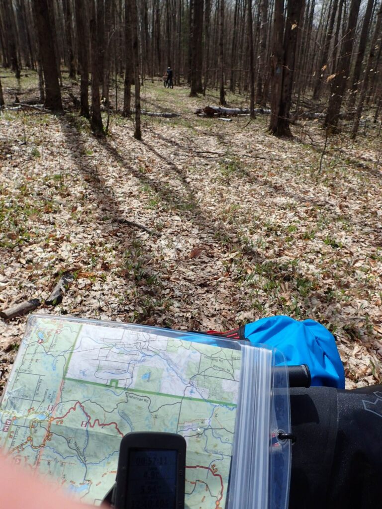
The only thing that separated us from our goal was 25 miles of wilderness. A lot of time was spent plotting a route using well known gravel roads, lesser known two-tracks, and a portion of the High Country Pathway single track. We had at least two members with programmed GPSr, paper maps with plotted routes, HAM radios, and our phones mostly for cameras. Cell coverage is very poor. Along the way we knew we would encounter hills, water crossings with bridges, and maybe a few unknowns. We planned well for what we knew and prepared our gear for what we thought could happen. What we didn’t know was that we were about to ride into a very different kind of day.


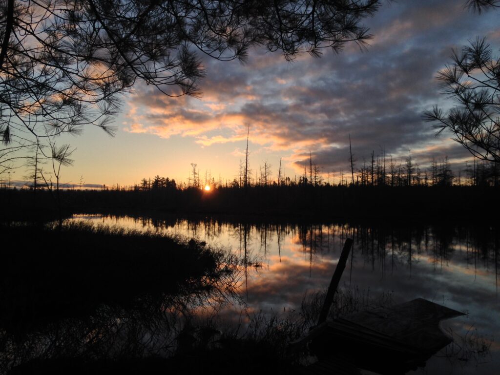
The morning of April 29th had pleasant weather, cool temps, and a nice sunrise.
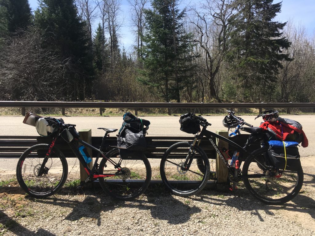
Once we were loaded up we headed out on the two-track to reach a gravel road. The debate between the speed of a 29er mountain bike and the flotation of a fat bike was settled in the first mile. The often sandy two-track gave the two of us without fat tires all sorts of trouble, especially when loaded with overnight gear and going uphill. In soft conditions, the two fat bikes were so good it hurt to watch. As we consider the ultimate machine for Expedition BikePacking the memory of bogging to a halt at every sand pit will bubble up. With unknown terrain ahead, tire width IS a consideration.
The High Country Pathway is an 80 mile wilderness single track that circumnavigates the Pigeon River State Forest. We chose a leg that would take us straight south toward our goal. We would intercept it along Webb Road just east of the Pigeon River crossing called “Red Bridge”.
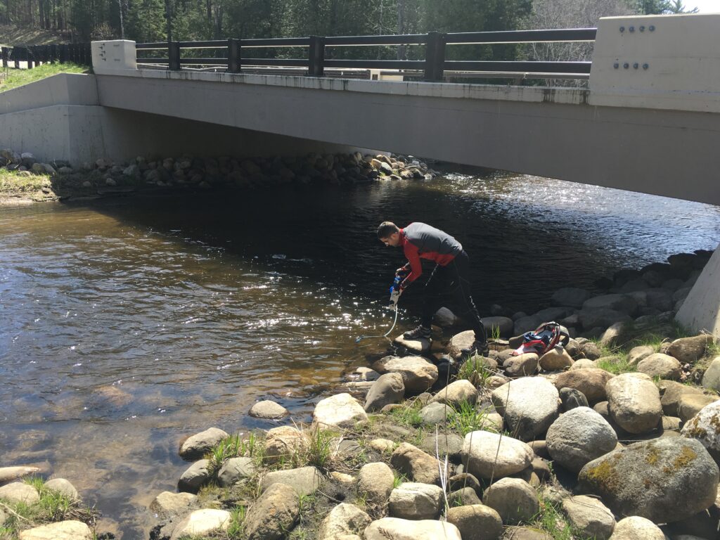
We stopped at “Red Bridge” to take in some sights and grab some water. The original red bridge has been replaced by a modern DOT monster but most maps still use the old name. It’s a great put-in spot for a paddler.
It’s called the High Country Pathway for a reason! It’s at the top of a series of hills.

All was well. We located the Pathway but the normal dirt center of a single track was missing. It was grown over. Trees had fallen across at an alarming frequency. The path had never been graded so our bikes were moving up and down as much as forward. It was immediately clear that this stretch was very technical and slow going. Constantly on and off the bikes for trees, we ‘broke trail’ south but were loving the challenge. It was fun crashing through the forest. It was good to be off the road and away from traffic. The sun was out and we were impressed with how much abuse a bike can take. We didn’t bother to stop for smaller branches. We just plowed over them letting the wheels and pedals grind them up. Our hope of seeing some wildlife was a little diminished though. We sounded like bulldozers.
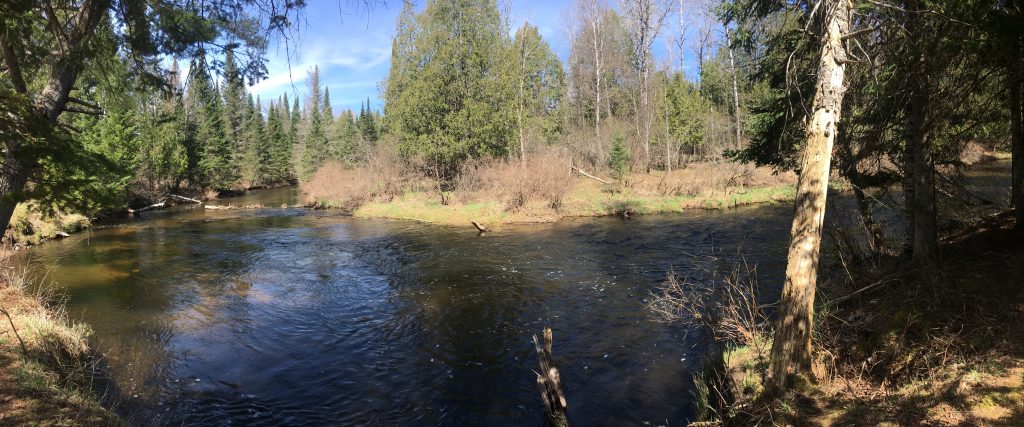
After a few miles of Pathway plowing we started to get the feeling of running behind schedule and opted for a two-track that paralleled the Pathway. This funneled to a campground filled with trout anglers. We were stopped by the Pigeon River and started to see a trend with a lack of trail blazes to keep forward progress going. Some nice people were able to direct us to a tiny path that led to a beautiful bridge. The photo op was not wasted.

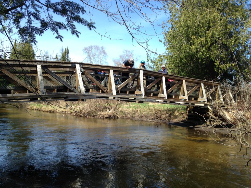
Things were looking up and it wasn’t even lunch time!
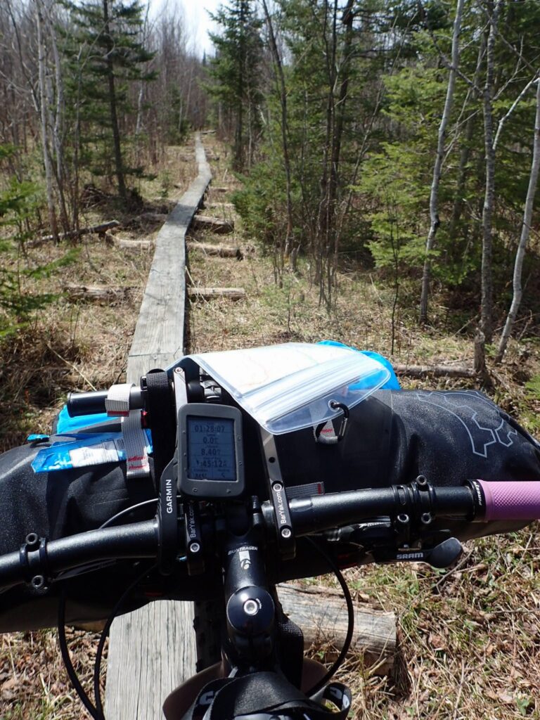
Truth be told, the Pathway south of the campground and bridge crosses wet lowlands. The trail builders have put in some effort to make hiking it more manageable with some boardwalk but riding a loaded bike was risky. At many points we had to resort to hike-a-bike, often giving the bike the wood board and taking the low road with our feet. We could tell that our seemingly innocent estimate of a 5mph average was going to be way high. We were walking bikes slower than we would hike with full packs. The Pathway was not the answer for the distance we planned in the time we had. The bridge photo op was about 1:30pm. Plenty of time for our fortunes to change but would we have the energy? Still, moral was high and we pushed on.


Soon the boards ended and a forest road took over. Huge puddles to go around and endless trees down were the main features. We popped out onto a well traveled two-track and checked the map. Soon an ATV went by and we waved. Hiya!
We were at a bit of a crossroads. We had a two-track that went kind of SE-W. The Pathway continued if we went west and IF we could find the blazes. We knew that option would probably lead to more slow going and we really just wanted to ride. The SE option at least had a south component. We would have to make up for the easting as our goal was west of us. Within a mile we hit the camp that the ATV was from AND we hit a locked gate “NON MOTORIZED”. This is a huge reason BikePacking can be so effective. We just go around the gate.
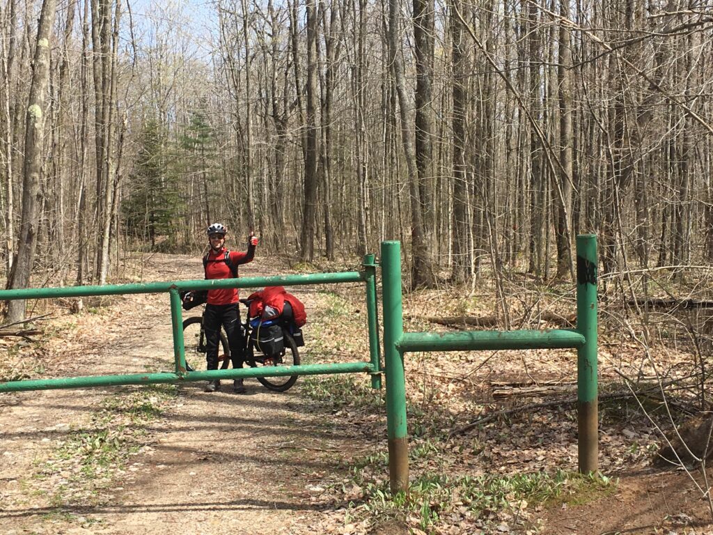
But first, lunch!
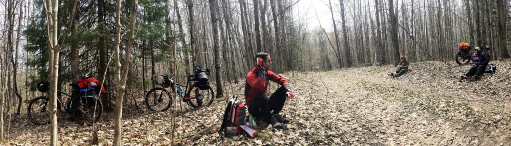

We had a nice little chat at lunch. We talked about how we needed to add some options to our plan and that as time was ticking, the probability of finishing those options was shrinking. Teammates contributed to this conversation freely and openly. It was a great collaboration.
Available daylight was not the only consideration. We were systematically wearing our bodies out. We could feel it. We are all experienced cyclists and we know eventually you can ride no more. We had zero concern for who would be first to wear out. The mission now was for the team to get to a stable location that would yield some sort of eventual exit.
The abandonment of the goal camp site was at the top of the list. Doing everything in our power to get to camp left us with the same situation to return to staging the next day plus the added fatigue of day 2. We also knew a low pressure system was fast approaching from the south and the whole place was soon to be soaked and 35F. Thoughts of hill climbing on wet leaves and hypothermia risks all factored into our next move.

We needed to go south and west. We could go northwest only to find the Pathway which we knew was terrible. We could go east which was unknown. We chose east. The two-track was great but we came to what looked like a long decent. Not wanting to risk all four members having to climb the hill out in case of a dead end, Spock decided to go down solo and scout it. Having radio contact with Hot Pockets was key.

A point was reached where visibility was good but terrain was otherworldly. The coordinates of that point were relayed to Hot Pockets and she led AquaPheonix and Kirsten into the fray. Pictured below is what they came upon.
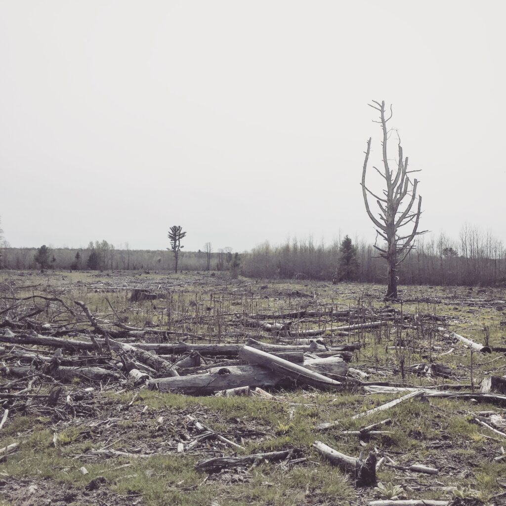
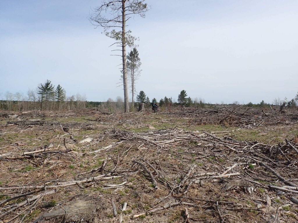
The 100 acre clear cutting seemed much larger in person. It is a wasteland for as far as one can see. The road that led into it soon made a loop and we were on our own to get out. At this point, we had come far enough to know Tin Bridge road was to our S-SE and that was the only option. It was over a half a mile away through yet unknown terrain.
Spock had moved across the cutting to try to find an exit while the others caught up. When they arrived they radioed him but couldn’t see him. Even in a red jacket he was too far and too buried in all the waste. He could see them silhouetted on the ridge and was able to signal them with his compass mirror. It works wonders if it’s sunny!

Once regrouped, we had a few laughs about just what on Earth we had gotten ourselves committed to. We pushed to the back side of the cutting hoping for a logging trail off the hill. No such luck. We found a drop too steep to walk and a swamp at the bottom. At this point we could see a small piece of the road due to a clearing but it was still 1/3 of a mile off.

Following the ridge we found the swamp reduced to a draw with a feeder stream in the middle. We could hike-a-bike around the entire draw to reach the other bank or try to find a way across. Spock went down to the water on foot to have a look because the draw was deeper than could be seen. We were tired of pushing bikes!
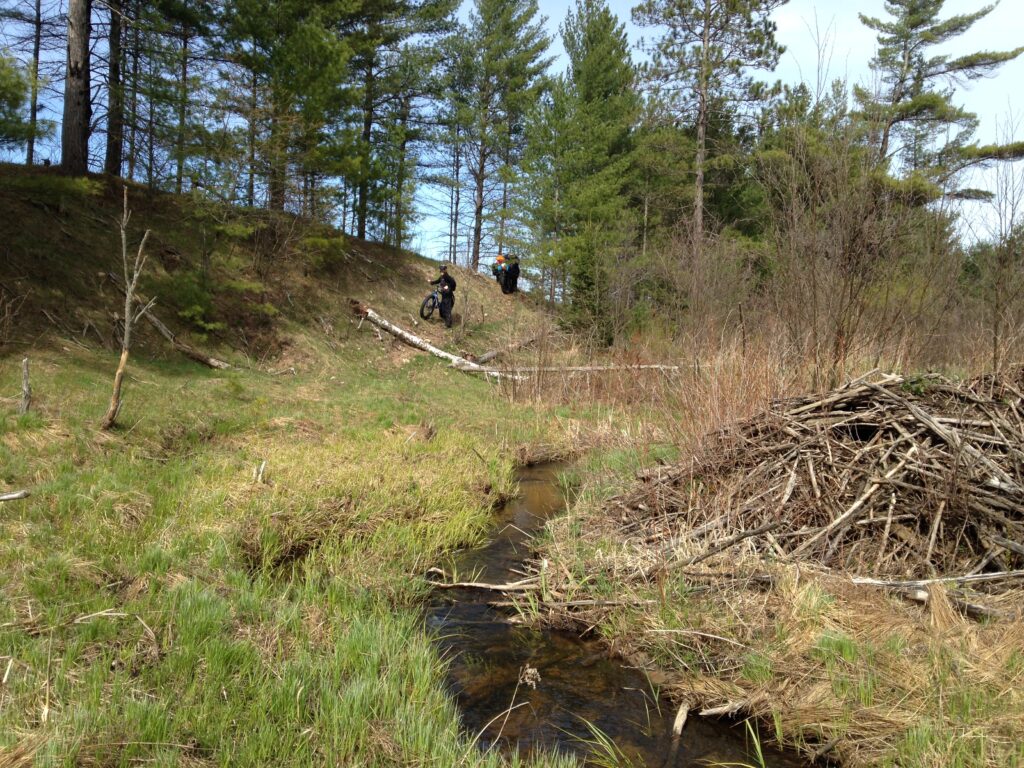
A game trail full of elk prints traversed the slope and the ground around the stream was surprisingly solid. He said ‘c’mon down’….


The stream was about 2 feet deep but easy to jump over. A piece of driftwood made a so-so bridge and the bikes were handed over one by one.

Thick bush was met on the south side and we played hike-a-bike again until we hit Tin Bridge Road.

Once out on solid gravel we could go about 10 miles to our original goal camp or about 16 miles back to staging camp. Both choices were gravel road the whole way. It was now after 5pm and the sky had turned grey. Knowing bad weather was coming we decided to leave our goal for another time and make sure we were out safe. If we wanted to find the goal spot the next day we could, but for now we needed to get somewhere solid before we ran out of daylight and energy.
Far from the average mountain biking day, we employed paper maps, GPSr units, HAM radios, shared UTM coordinates, improvised a water crossing, battled trails only an elk would be happy on, and came away with the unique sense of camaraderie that can only be gained when a team embraces the challenge and works together to overcome it. It was a great ride.
Gravel roads are boring but they are predictable. As we picked up the pace Kirsten later admitted she thought to herself, “16 miles??? Oye!!!!”. It was about then, she said, that Hot Pockets pulled over to shed a layer. Under her coat was her FBET T-shirt which reads on the back “We Go Farther”. Kirsten said when she saw that she shook off her worries and uttered, “You’re darn right we do…..we do go farther.” It’s just how we roll.
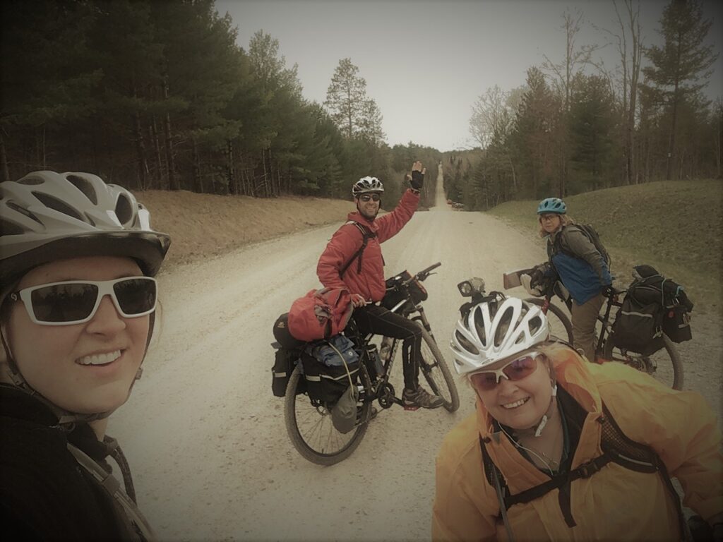
Here’s one last selfie before the final legs to staging.
We beat the sunset by about an hour and had some hot food and shared stories around the fire. The rain came at 3:00am and by daybreak it was windy and 37F. The gear went straight into the vehicles and we went straight to Indian River for “large portions” of breakfast. Our mission was to explore this wilderness and place a navigation challenge. The challenge will be placed next time.
Aside from the adventure, we gained valuable experience with our bikes and saw teamwork to the highest degree. The last thing we said to each other as we parted ways in the parking lot after breakfast was “When is the next one??!!!”
Won’t you join us?

