The McCormick Wilderness covers about 17,000 acres of Michigan’s Upper Peninsula and most people enter from the south gate, following the maintained trail to White Deer Lake as Fortune Bay did in 2018. But the north entrance provides access to two amazing waterfalls, as well as thousands of acres of trackless woods and hidden lakes that few people explore. Jay and Liz decided to make a 3-day backpacking foray into this end of the Wilderness, to scout locations for a future Fortune Bay excursion.
There are only a few maintained trails in the McCormick Wilderness, but many years ago the McCormicks had an extensive network of trails. The following map is from mccormicktract.com and it shows the trails and other features as they existed in 1935. Although the original trails have mostly disappeared, they still represent reasonable travel routes through the wilderness and we tried to follow some of these historical trail routes during our exploration. Click the image below for a full-size view.

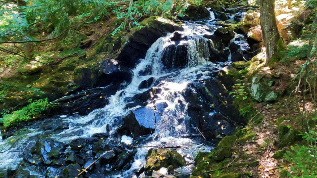
Day 1 – Endless Waterfalls
We hiked in from the north trailhead and spent most of the first day climbing up two branches of the Yellow Dog River and exploring the two waterfalls that seemed to go on forever. Here’s Part 1 of our adventure:
GPS Coordinates
North Entrance: 46.73489, -87.97592
West Branch Yellow Dog River crossing: 46.72288, -87.96203
Yellow Dog Falls: 46.72269, -87.96237
Main Branch Yellow Dog River crossing: 46.71998, -87.94995
Bulldog Falls: 46.71509, -87.95201
Bulldog Lake campsite: 46.69374, -87.97986
Day 2 – Climbing the Acropolis
From our campsite on Bulldog lake we hiked northwest to climb a hilltop called the Acropolis. Then we continued northwest to reach Lake Phillips.
GPS Coordinates
Bulldog Lake campsite: 46.69374, -87.97986
The Acropolis: 46.70431, -88.01078
Lake Phillips campsite: 46.71282, -88.02139
Day 3 – Peat Bog Tea and Lichens Galore
On Day 3 we leave Lake Phillips and head east toward our starting point, drink from the tannin-stained headwaters of the West Branch Yellow Dog River, and find an amazing colony of lichens.
GPS Coordinates
Lake Phillips campsite: 46.71282, -88.02139
West Branch Yellow Dog River headwaters: 46.71895, -88.00557
Panorama Hill: 46.72237, -87.99895
North Entrance: 46.73489, -87.97592