July, 2016
Just sit right back and you’ll hear a tale, a tale of an awesome trip; that started from this northern port, aboard these tiny ships…
Day One (7/27/16) Rendezvous Camp – Michipicoten, Ontario, Canada
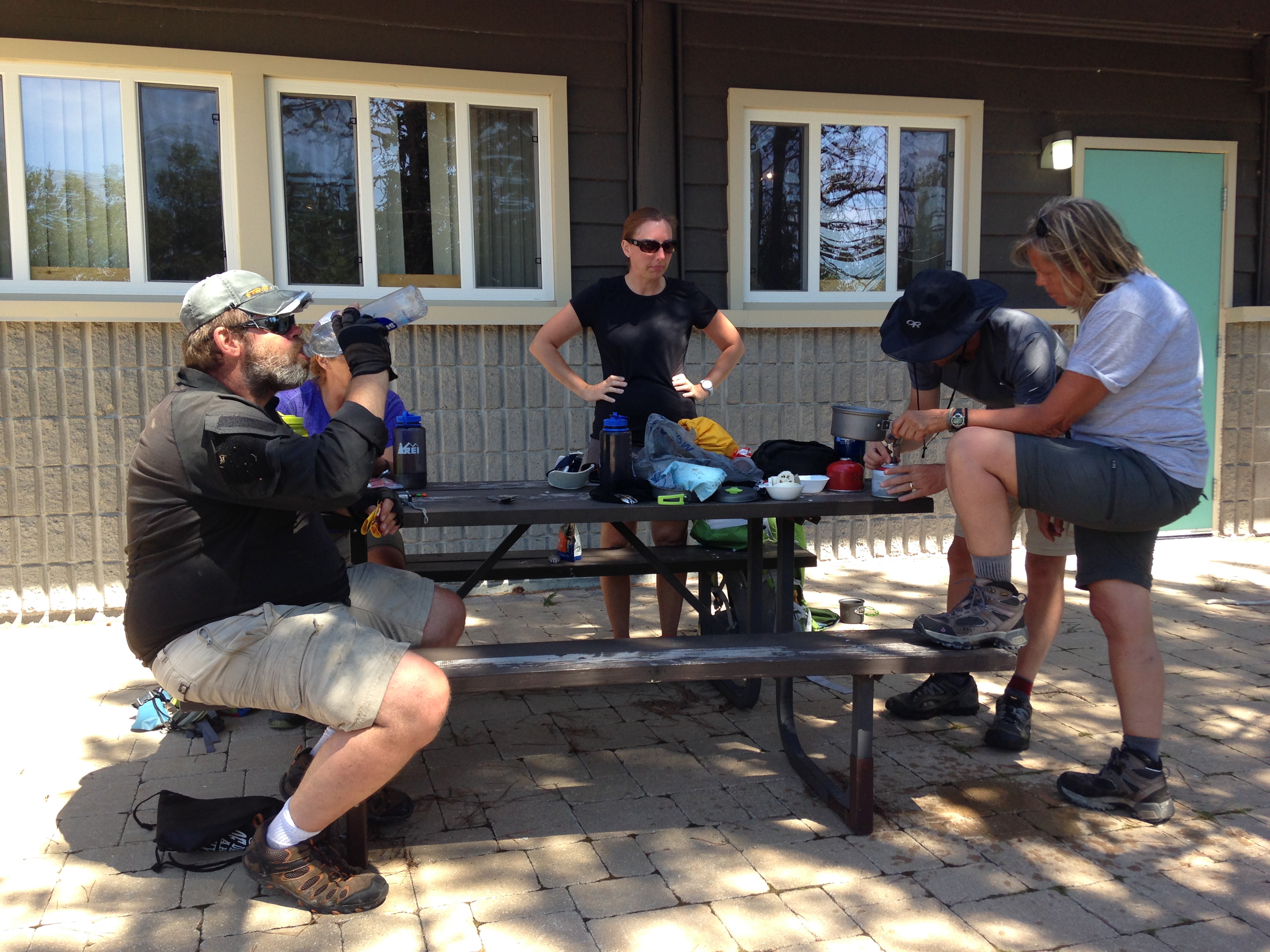
We began our trip heading far north from our home base in Grand Rapids into Ontario Canada. Most of the group had already arrived prior to the 7:00pm arrival; the others were close behind.
This was an exploratory expedition, and with any exploration into the unknown, things do not always go as planned and often results in impromptu changes. A rendezvous campsite was selected based on an evaluation of topographical maps and areal images of Crown land near Michipicoten, Canada. We were expecting to find a clearing off of a dirt road surrounded by forest and a small river. What we were not expecting to find was the clearing overgrown in some areas with 5ft brush and swarming with mosquitos, flies, and a number of other insects ferociously attempting to gain access to the vehicle. The team was in good spirits about the un-campable location and laughed uncontrollably as we ventured off to a new location nearby that Spock had discovered earlier.
The new camp location offered a number of amenities to suit the team; wide open space to park all of the vehicles, grassy area for tent set up, a clearing big enough to build a suitable fire, and even a field of wild blue berries and raspberries for the hungry expeditioner…or bear. Ok, so we were pitching our tents in the middle of a bear’s dining room; that didn’t deter us for long though. We also managed to locate a number of bones, most discovered by Bones herself, that were quite large, we could only assume they belonged to a Moose at one point.
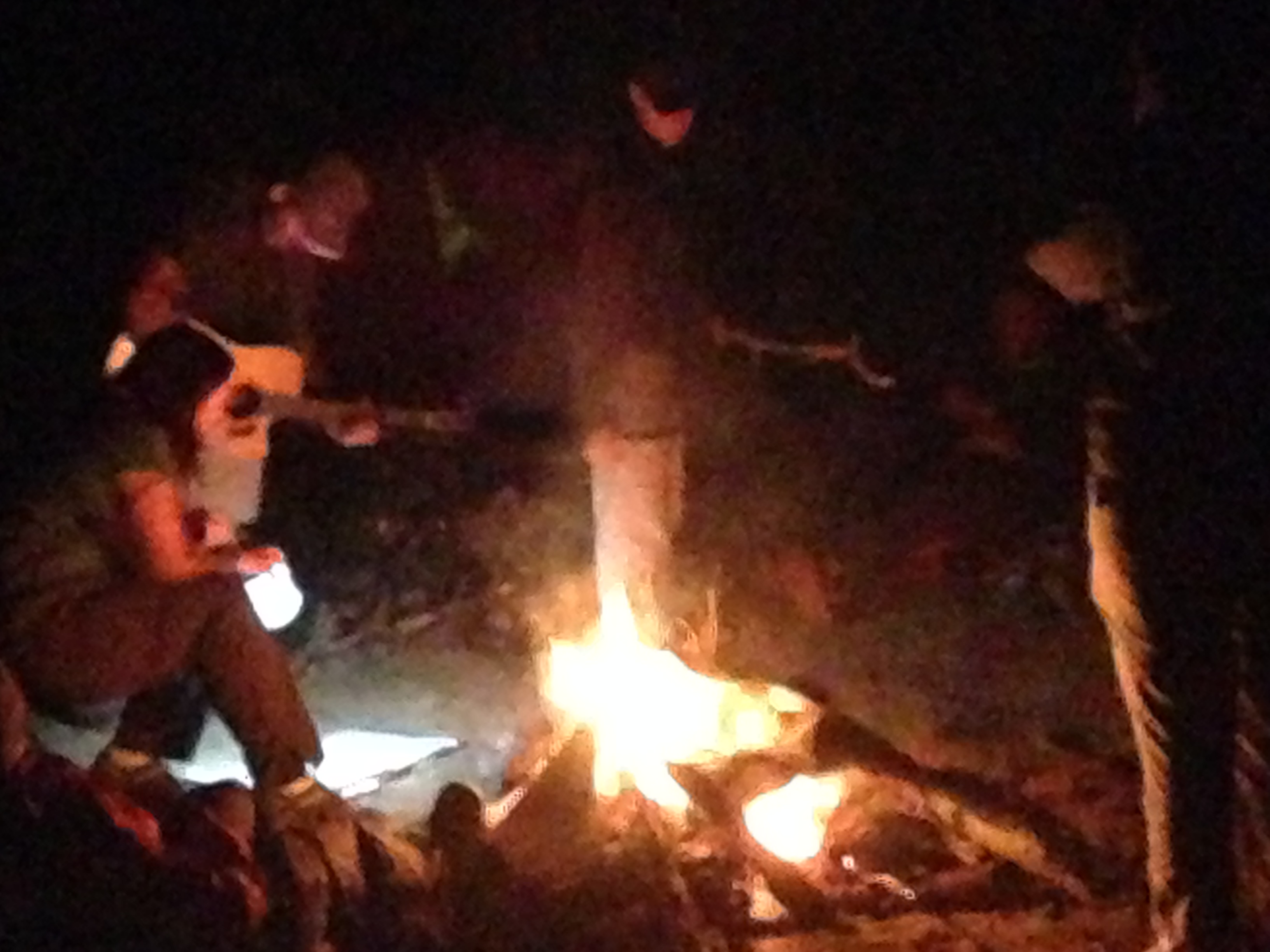
We settled in for the evening around a roaring campfire and enjoyed our meals while getting to know one another better. When dinner was over, Pathfinder and AR sang songs with the guitar, encouraging others to join in. While only a few could manage a tune, it did not stop everyone from laughing and singing along to the tune of Edmund Fitzgerald.
Day Two (7/28/16) Marathon, Ontario, Canada (Skin Island, Craddock Cove)
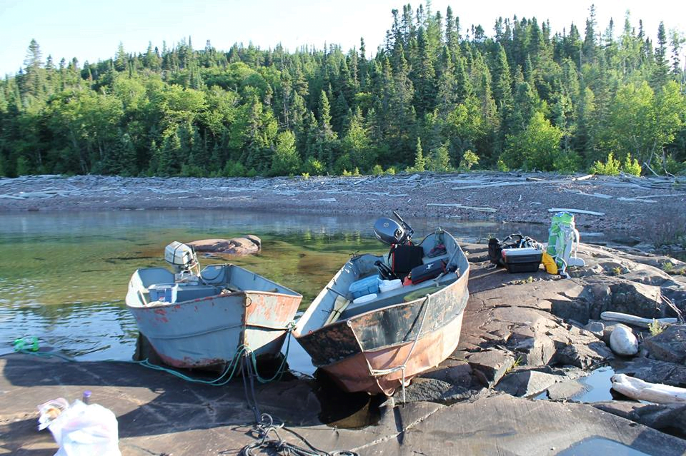
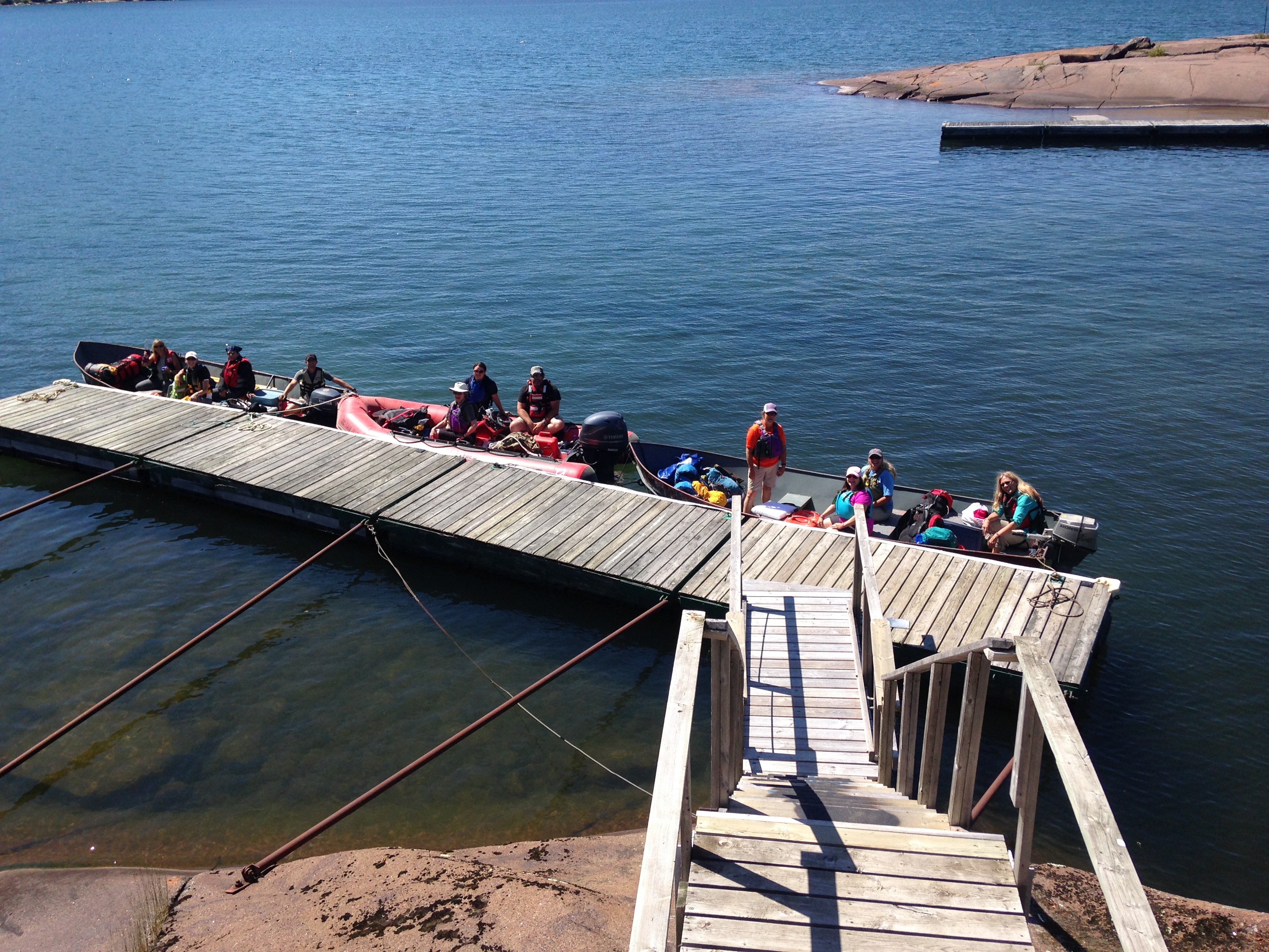
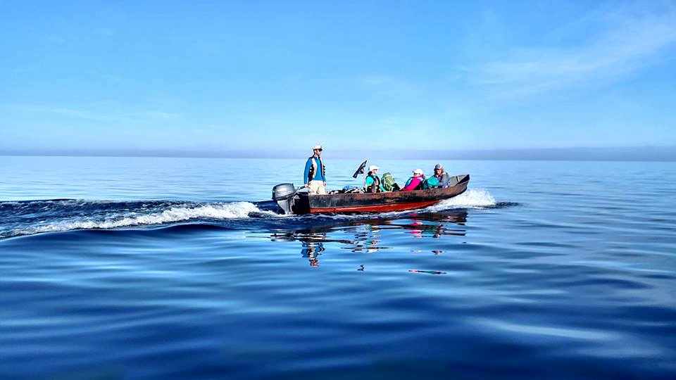
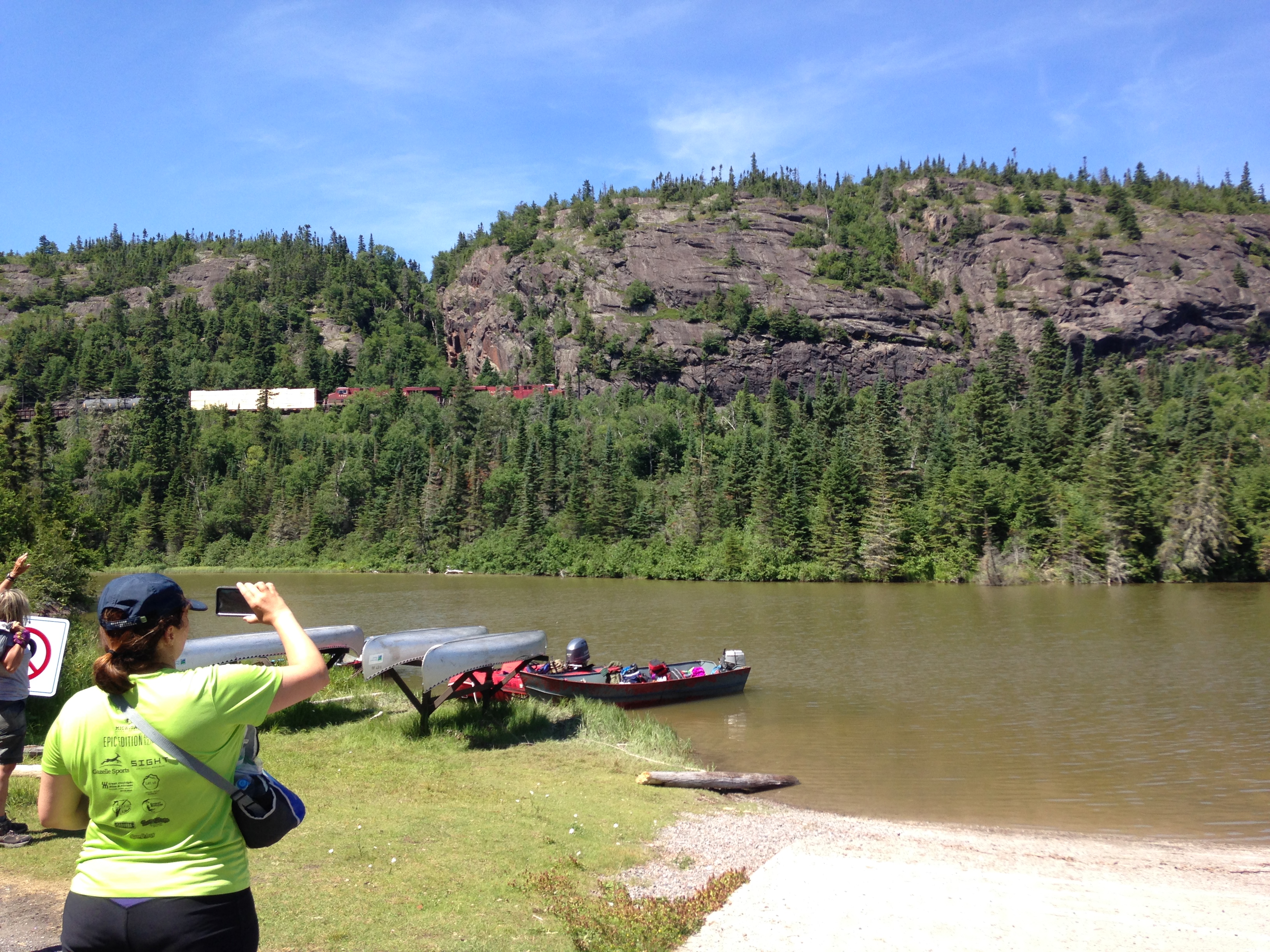
The next morning we arose eager to start our journey. After a short stop at Tim Hortons, with everyone else traveling up the highway, we travelled north two hours to the small town of Marathon, Ontario. Here we rented two 17ft steel punt boats from Keith McCuaig of McCuaig Marine that would take us across Lake Superior to explore the islands and surrounding areas. To the average person, the boats were nothing spectacular; glorified fishing or row boats. But to us, the boats signified adventure, and you could see the excitement in everyone’s eyes (maybe a little bit of terror in some knowing we would be venturing out of our comfort zones fairly shortly).

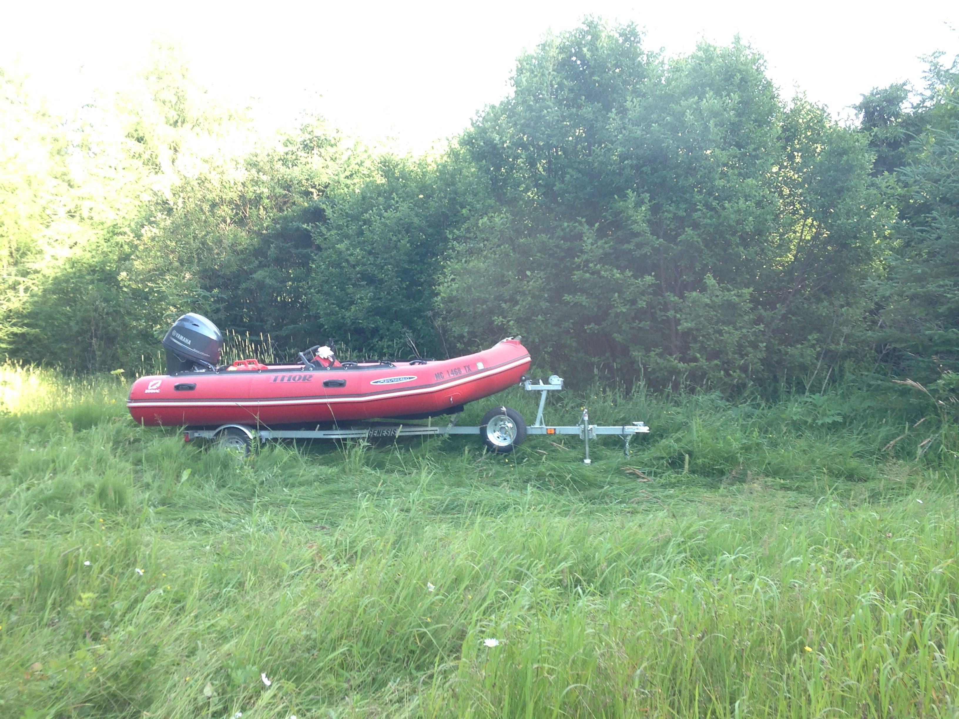
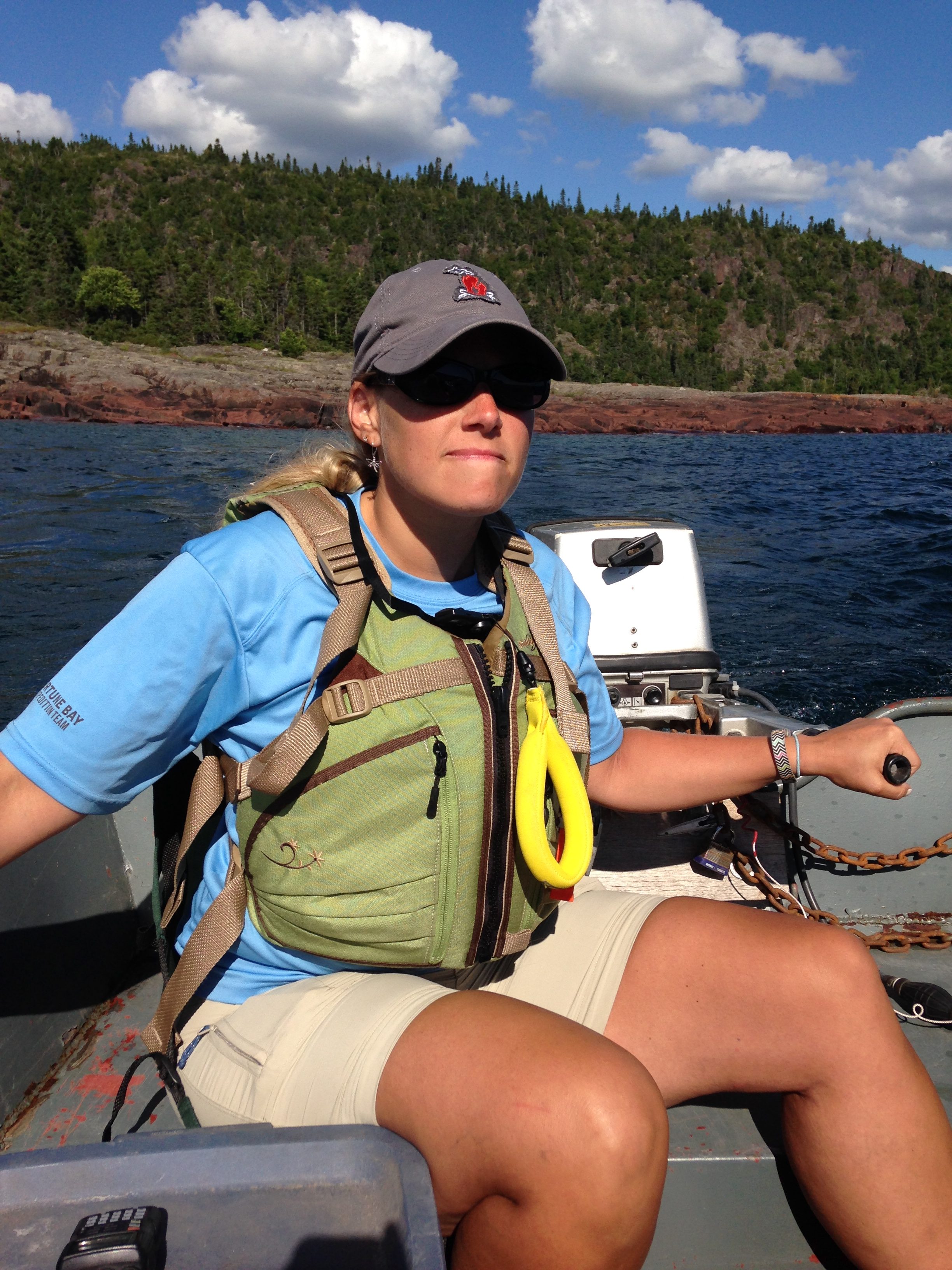
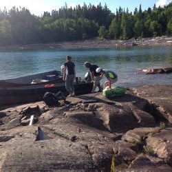
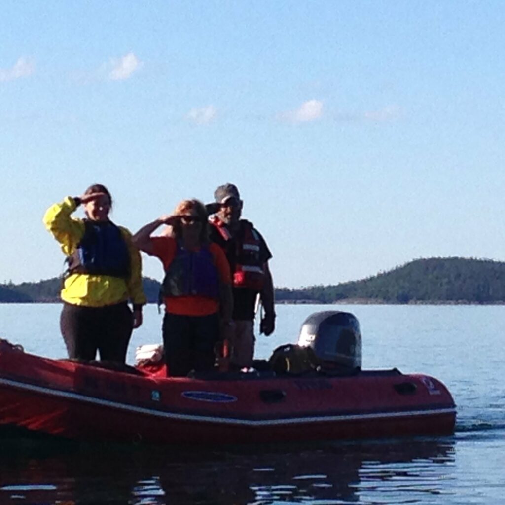
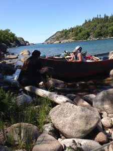
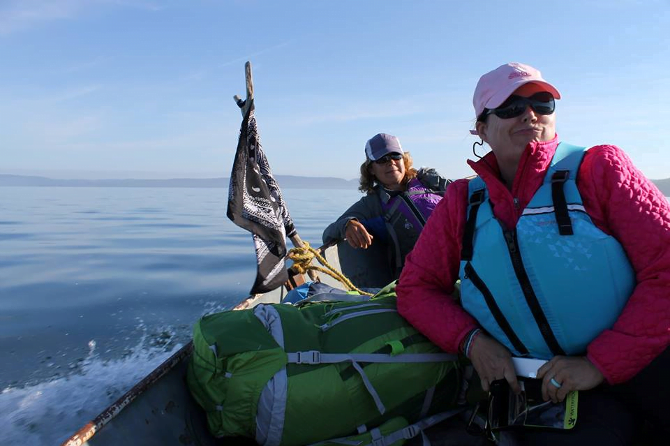
After ensuring the boats were in order and fuel was stockpiled, Keith McCuaig led us to the boat launch where we loaded our gear, took some candid photos, and waved goodbye to the mainland and society as we ventured off into the unknown. The two boats were manned by Killer Bee and Spock, while Pathfinder captained the Zodiac. Each boat held four passengers and gear, while the Zodiac held only three passengers due to its smaller capacity.
The first stop on our journey was a short boat ride away to Skin Island. Skin Island is rumored to once been a brothel. The outer edges of the island were surrounded with slick rocks, whereas the interior of the island was dense forest. We walked the entire circumference of the island in search of a Geocache and potential remains of the once brothel that stood there. There were no trails that led into the interior of the island that we came upon. When we came to the coordinates of the Geocache, we were forced to bushwhack in to search for it. It was getting late now, so rather than continue to search for the Geocache, we opted to return to the boats and be on our way to our next destination.

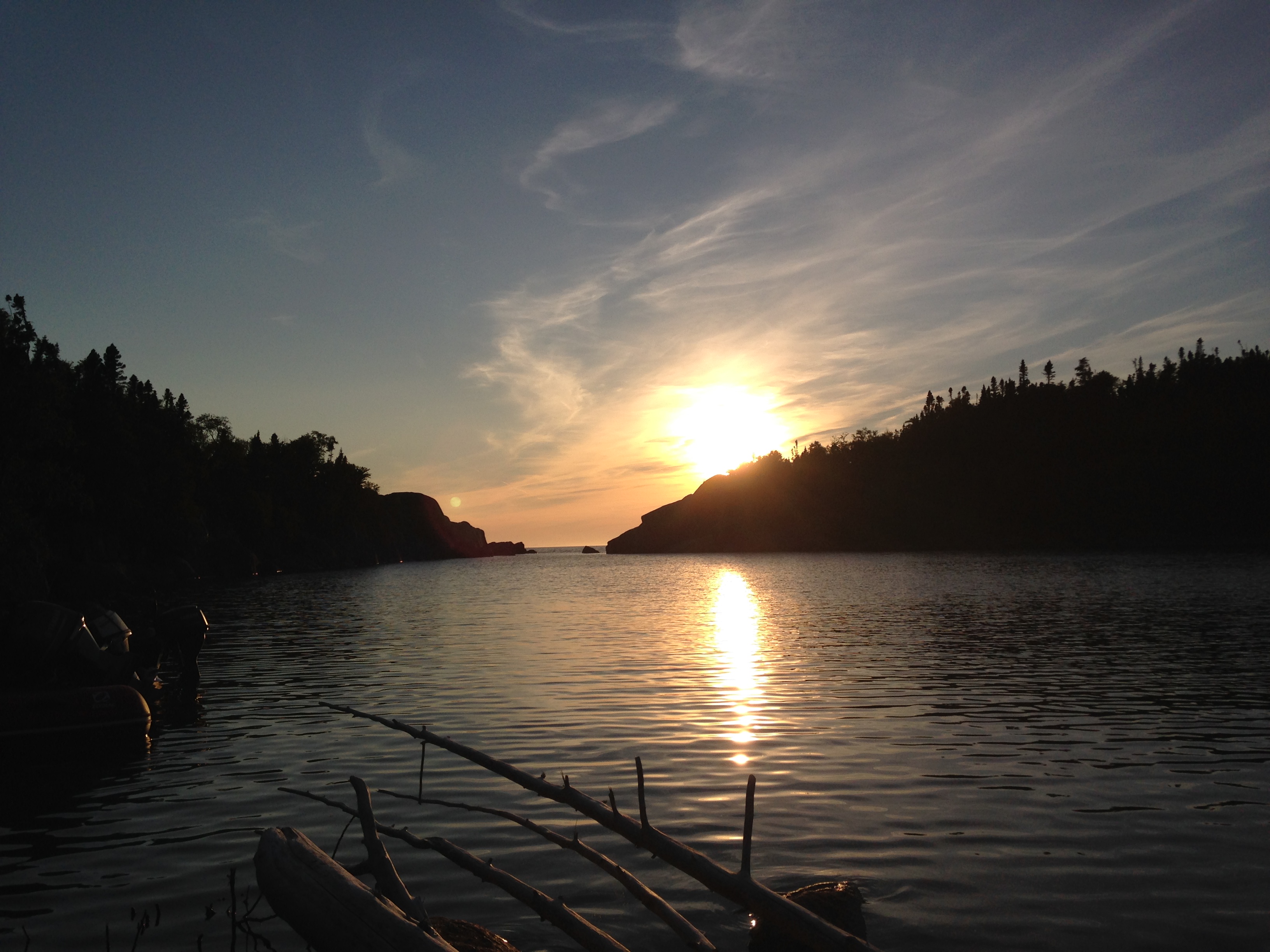
Shortly after departing, the wind picked up slightly and the waves of Lake Superior became rough for the little boats. Selfie, who was much more experienced with boating than Killer Bee, volunteered to help steer the boat through the rougher waters. Selfie, Spock, and Pathfinder maneuvered the boats to shore, and calmer waters, where we set up camp for the night in Craddock Cove.
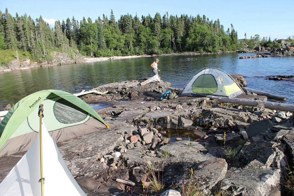
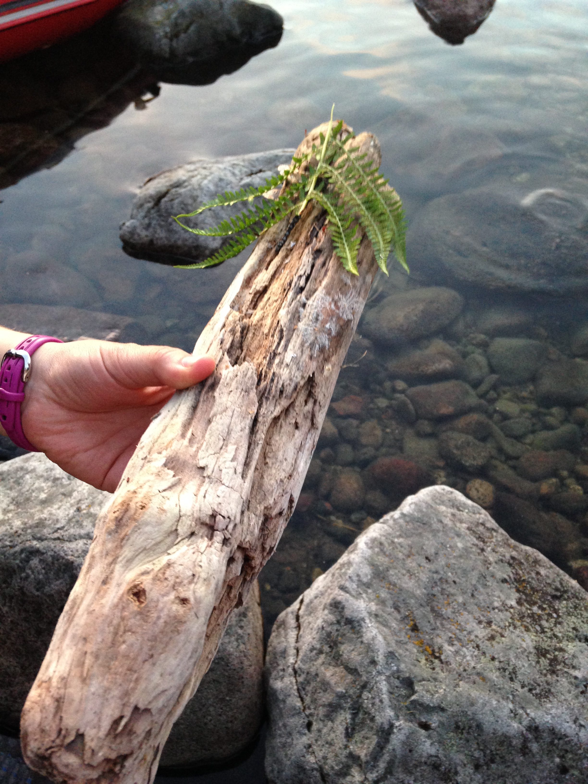
The beach of the cove was covered with rock and driftwood. A small section of large mostly flat rock and boulders protruded from the island. Many of the team opted to set up camp along the flat rocks overlooking the cove in hopes the tide would not wash the tents away in the night. An area was also designated for the fire pit for the evening. A few of us took the plunge in the frigid water in an attempt to de-stink. Any impromptu bathing was short lived due to the coldness of the water. Although the air became chilly on this evening, we remained, for the most part comfortable due to the heat from the fire and the warmth of the rocks that had retained much of the sun’s heat from the day. Being right on the water, the mosquitos were a bit of an annoyance, but nothing that bug spray and gear didn’t deter. We spent the night playing Euchre and laughing around the campfire before heading to our individual tents.
Day Three (7/29/16) Ontario, Canada (Red Sucker Cove, Port Coldwell, Allouez Island)
The next morning we awoke bright and early, as well as a bit groggy. We quickly re-packed our gear and loaded the boats to get an early start on the water. Selfie and Killer Bee agreed to share in the Captaining of the one boat due to Selfie having more experience on the water and Killer Bee having thrown her back out the day prior. The boats headed west along the shoreline from Craddock Cove to Red Sucker Cove, where the Zodiac team placed a Geocache in the name of Fortune Bay Expedition Team. The Geocache was hidden amongst the rocks near the train tunnel. Due to limited docking options available, only the Zodiac was able to go to shore for this excursion.
The team then ventured further west to Port Coldwell, where they explored the sunken ruins of a freighter or some form of factory. We later went to shore and hiked to the old Coldwell cemetery which is still maintained to this day by the railroad. We headed back to the beach for lunch and a breathtaking view of the area.

From Port Coldwell we made the long journey south west to Allouez Island. The initial plan was to camp on Pic Island, a large land mass south of Neys Provincial Park; however, the topography on the map revealed camping would not be ideal. We instead opted for Allouez Island, which lay further south.
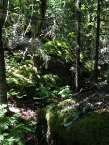
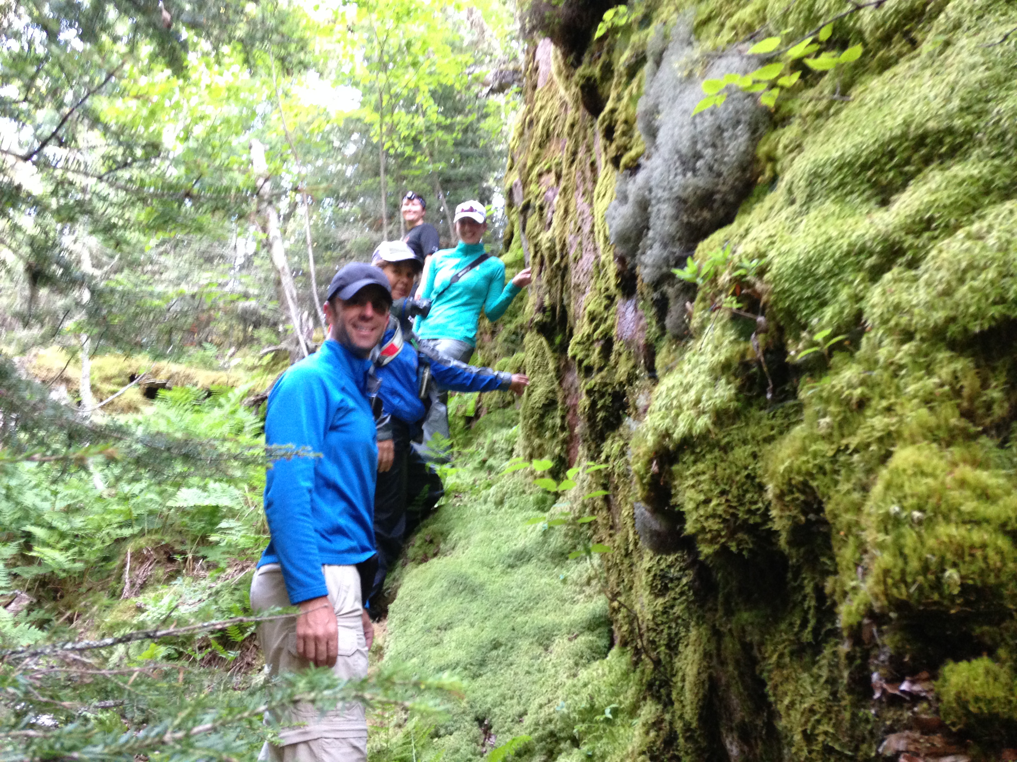
The entrance into Allouez Island Cove was littered with rocks and boulders, requiring a steady hand to maneuver the shallow waters. The cove was surround by rock walls and dense green forest. The beach itself was minimal; rocky and scattered with driftwood and fallen logs. The interior of the island was dense forest and much of the ground was spongy due to years of deadfall. Pitching tents required some ground work to remove rocks, vegetation, and roots that lay everywhere. Although not the most ideal camping spot, we opted to make the best of it.
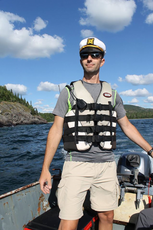
It was still early in the day, so we opted to do more exploring after camp was established. Two-Point chose to stay behind and guard the camp against potential invading pirates. The rest of us headed back north to the mainland of Neys Provincial Park and explored an area with hardened lava flows and abandoned POW boats. Having become separated from the group, Spock, Knee High, and Selfie proceeded to ask the locals for help in locating a Viking who was traveling with a number of women. Spock’s attire consisting of a captain’s hat, cop glasses, PFD and radio, combined with his professional demeanor only made the incident more amusing.
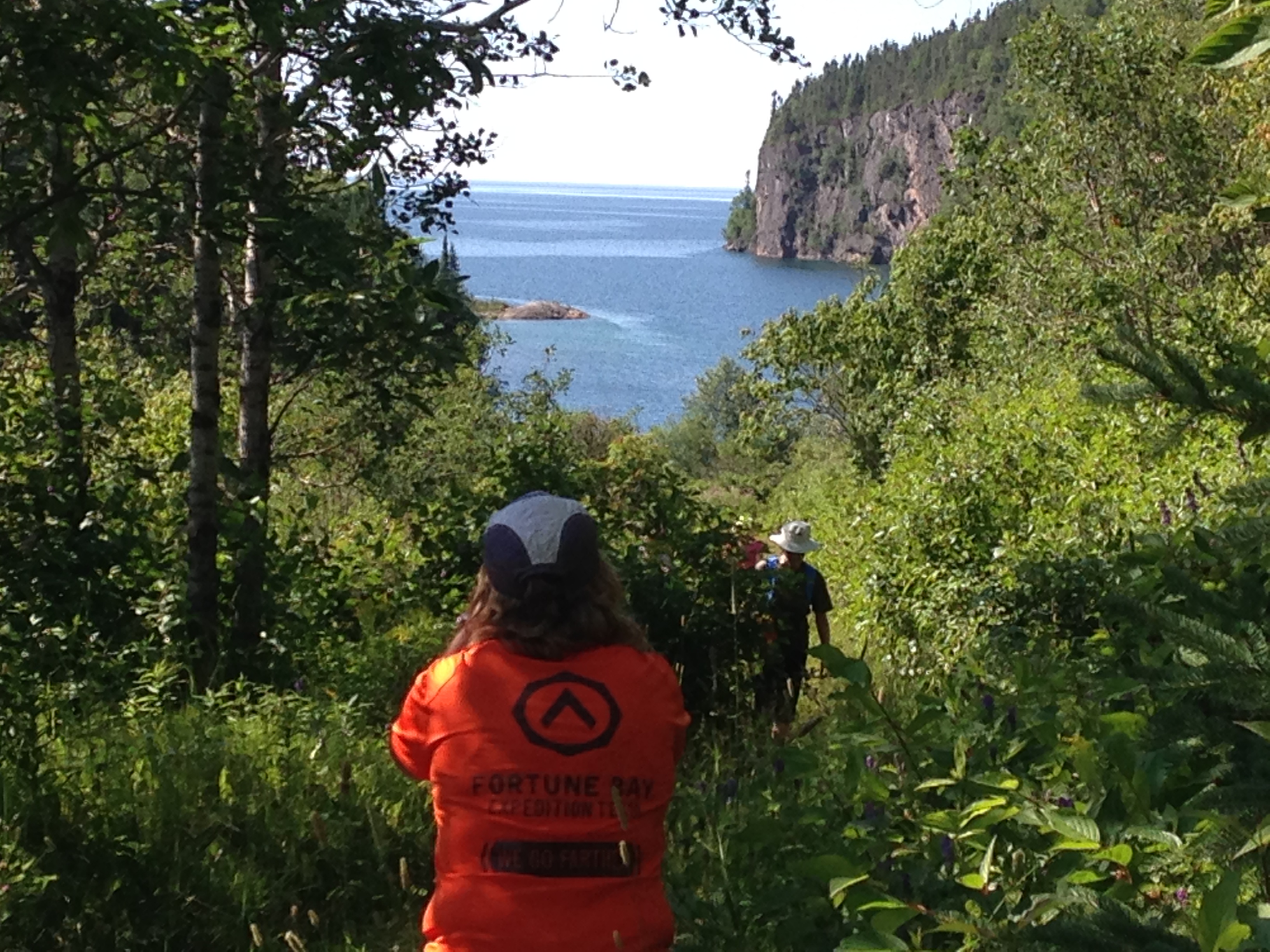
After regrouping, the team made its way back to Allouez Island. With only a few hours before sunset remaining, the team decided to search for a route that would lead to the summit of the island. We located what appeared to be a long since overgrown trail and made our way to the summit with only minor bushwhacking and questionable terrain. The view from the top overlooked the entire cove of the island. We could see Reroute, Two-Point, and Awesome on the beach far below. After relaxing for a few moments and taking in the breathtaking scenery, we made our way back to the beach to join the others for dinner.
Unfortunately, just as the sun was setting, one of our dear friends, Herman Ragnar Drakenfly, passed away. Sadness overwhelmed the team as we bid him farewell in a Viking style funeral. Pathfinder provided the eulogy, while AR and Killer Bee prepared the ship burial that would take poor Hermon to sea. Spock whistled the Taps tune as Hermon floated off to sea.
The sun proceeded to set behind the rocks. While many of the group chose to head in for the night at this point, a few other decided to stay up around the fire laughing and telling stories until eventually we chose to also call it a night.
Day Four (7/30/16) Neys Provincial Park, Ontario, Canada
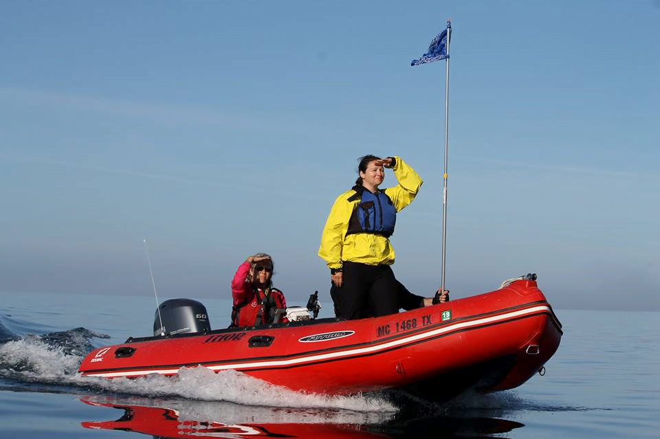
We awoke early again the next morning and quickly loaded the boats in anticipation of the day to come. Killer Bee was given the opportunity to ride in the Zodiac this time with Pathfinder and AR. Knee High pointed out that all of the leaders of the expedition were now in one boat. This will forever be known as the “Eggs in One Basket” protocol. We set out on the long journey from Allouez Island, around Pic Island and further north up the coast of Neys Provincial Park. Our destination, a hike known by few, and mostly only by locals located along the Little Pic River. We raced across Lake Superior to our destination with our homemade flags blowing in the wind. Killer Bee took them helm of the Zodiac and whipped around the other boats as Pathfinder captured video on the Go-Pro for later use. Everyone was in great spirits.
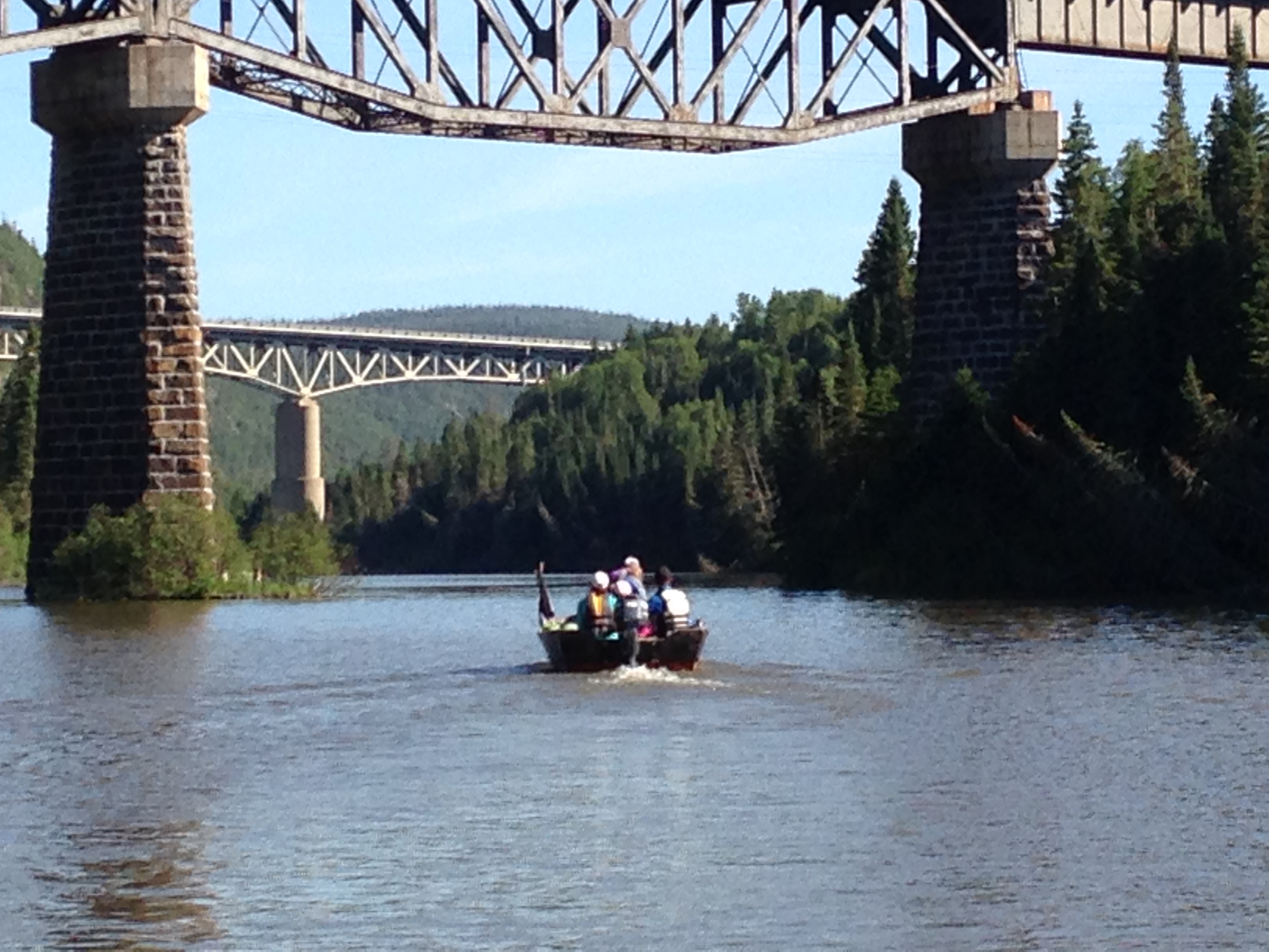
We arrived at the Little Pic River, which we discovered to be very shallow. A sandbar gave the appearance that the river simply ended. A shallow bend allowed us to maneuver safely into the main part of the river. We continued down the river for a short way, all the while being followed by a playful otter. We approached the under pass of the train bridge and determined the water was too shallow and littered with underwater debris to continue on. We turned around and headed back toward the mouth of the river where we tied the boats up.
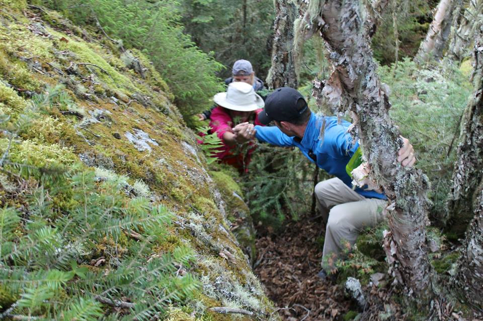
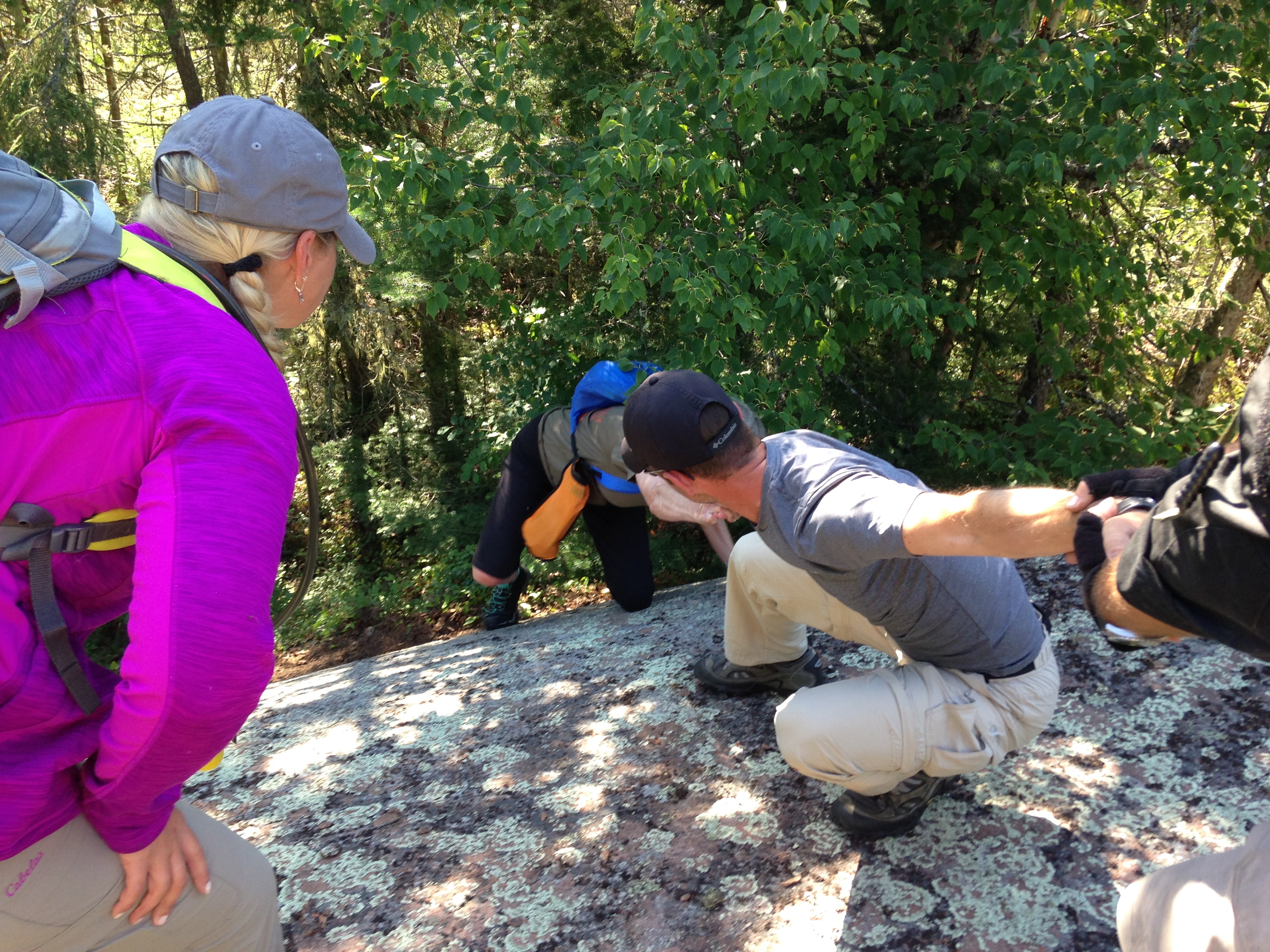
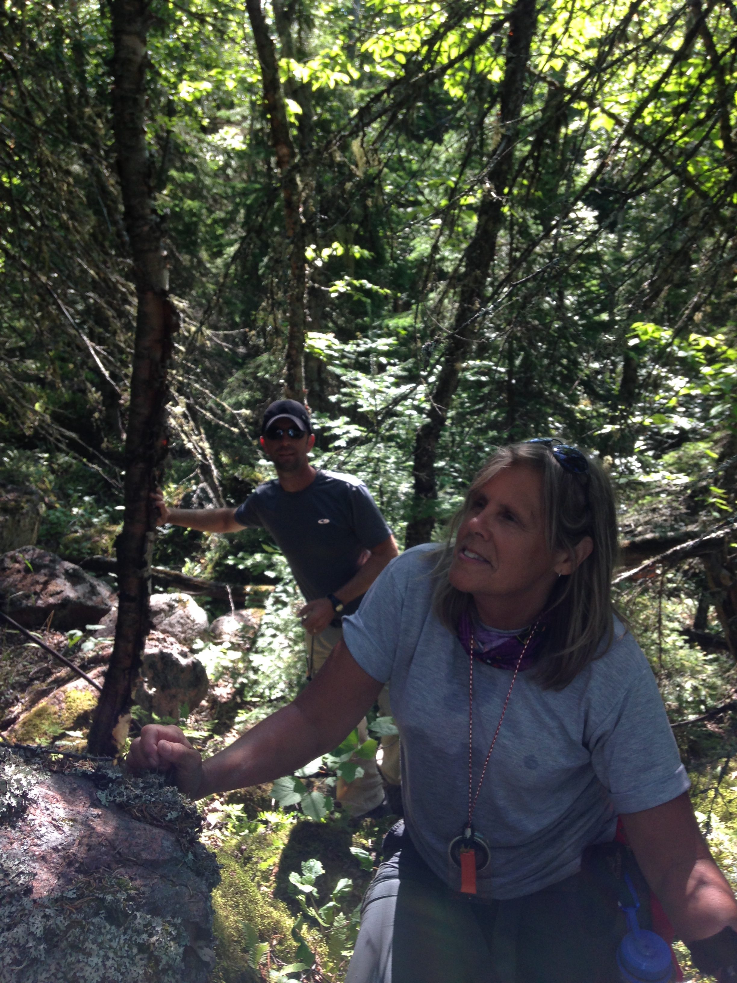
Awesome, having watched a video in advance of the hike we would be doing, chose to stay behind and instead veg on the beach with a good book. She bid us good luck as we ventured into the thick of the woods in search of the train tracks somewhere north of us. At one point our makeshift trail led us to a giant boulder. The team work was amazing as everyone helped each other to reach the top of the boulder. We ascended deep into the woods before finally locating a rocky clearing that led up to the train tracks.
It should be noted that we were not allowed to be anywhere near the tracks should a train pass. Fortunately, the train passed only moments prior to ascending to the tracks, so we knew another would not be by for some time. We headed down the tracks in search for the infamous “Crack” that we would be hiking. To say the entrance to “The Crack” was difficult to locate would be an understatement. The entrance is merely a small hole in the side of the mountain under a boulder. A few areas appeared to be the correct location; however we quickly learned the path led to nowhere. The correct location was located further down the tracks.
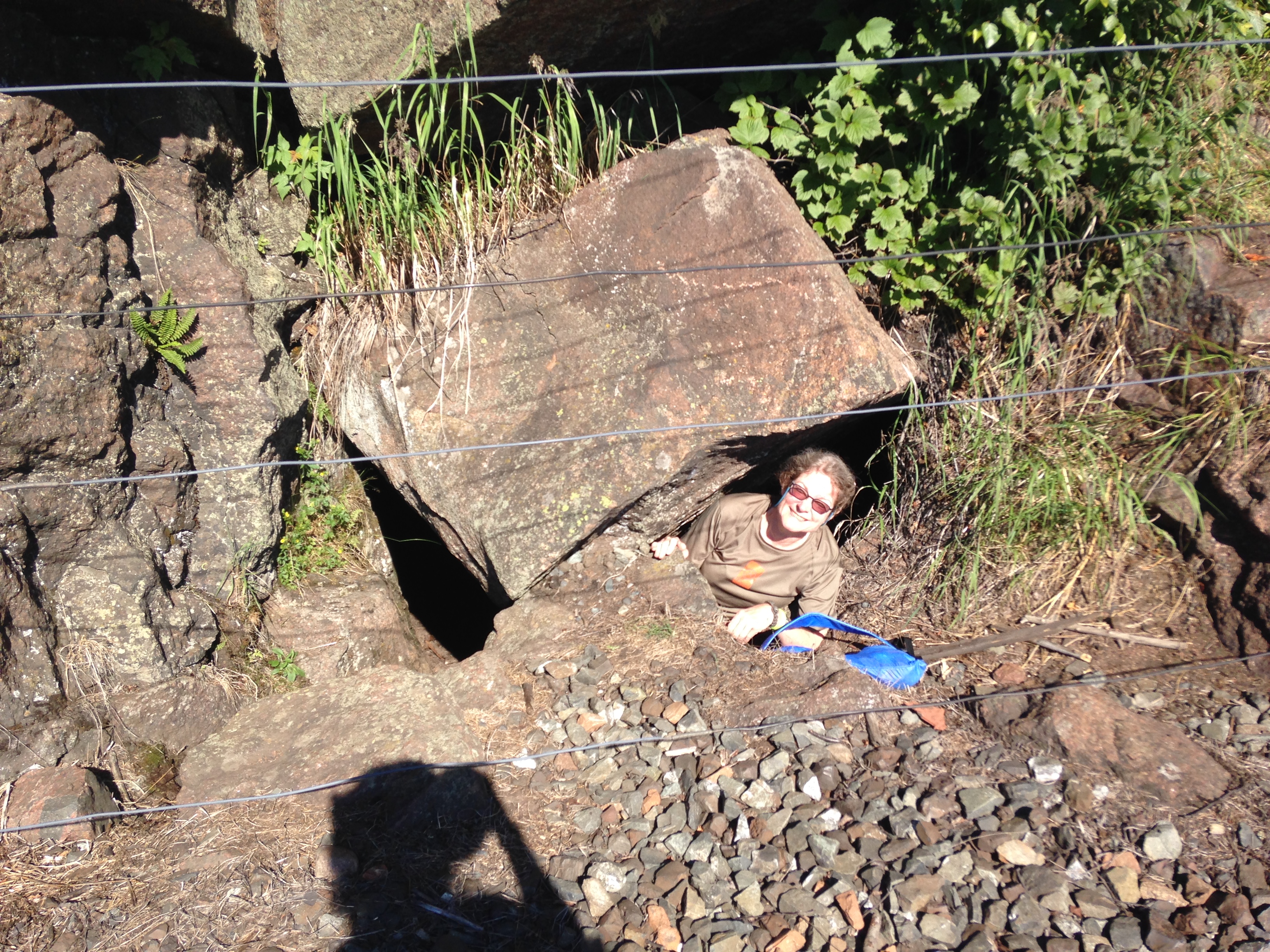
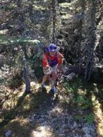
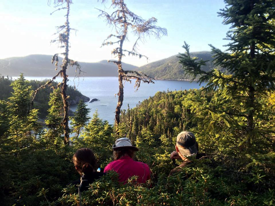
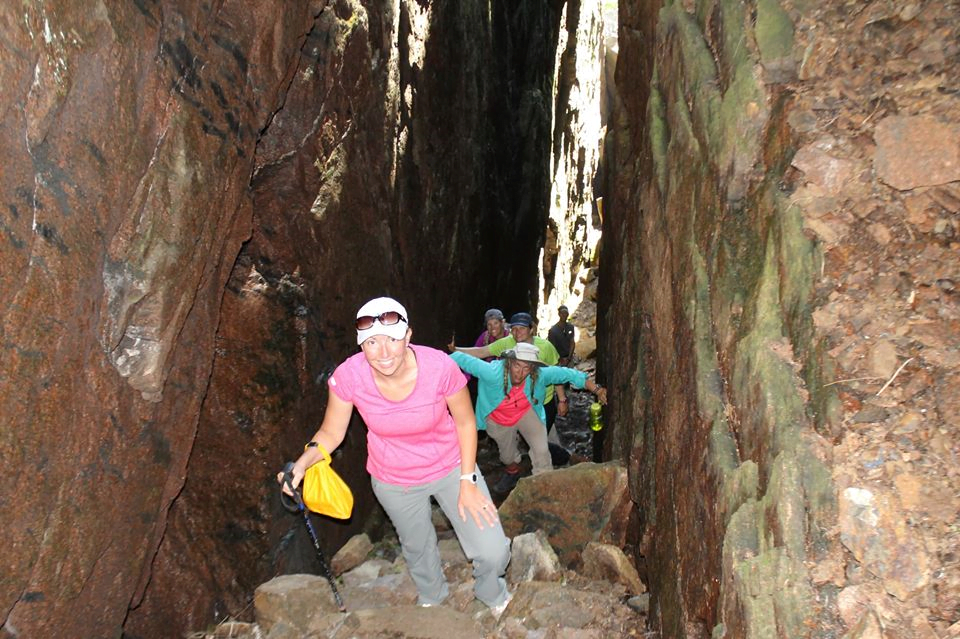
Reroute was the first to enter the hole. Inside, the crack opened up allowing everyone to stand freely. Bags had to be handed down into the hole and placed along the wall until all members could climb through. It was an awkward, tight fit, but everyone was able to climb inside. The crack hike is not an official trail, nor is it meant for those with severe claustrophobia or fear of heights. The walls of the crack were in some areas wide enough that two members could stand side by side, while in other areas barely shoulder width apart. Much of the hike required a scramble up the cold wet rocks and required members to firmly position themselves against the rock using natural hand and foot holds, while a member directly above them continued to climb higher. Eventually we reached the top of the crack which required the use of tree roots as rope to pull oneself out of the opening.
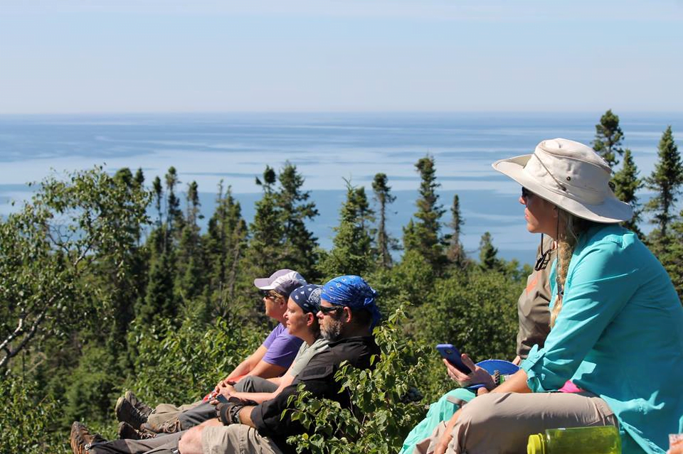
We had reached the top of the mountain. The view was amazing! We could see for miles. After noticing some folks down below on the beach and waiving, Pathfinder proceeded to holler at them asking for beef jerky. They didn’t have any. We were able to reach Awesome on the radio also and were able to see her on the beach below as well.
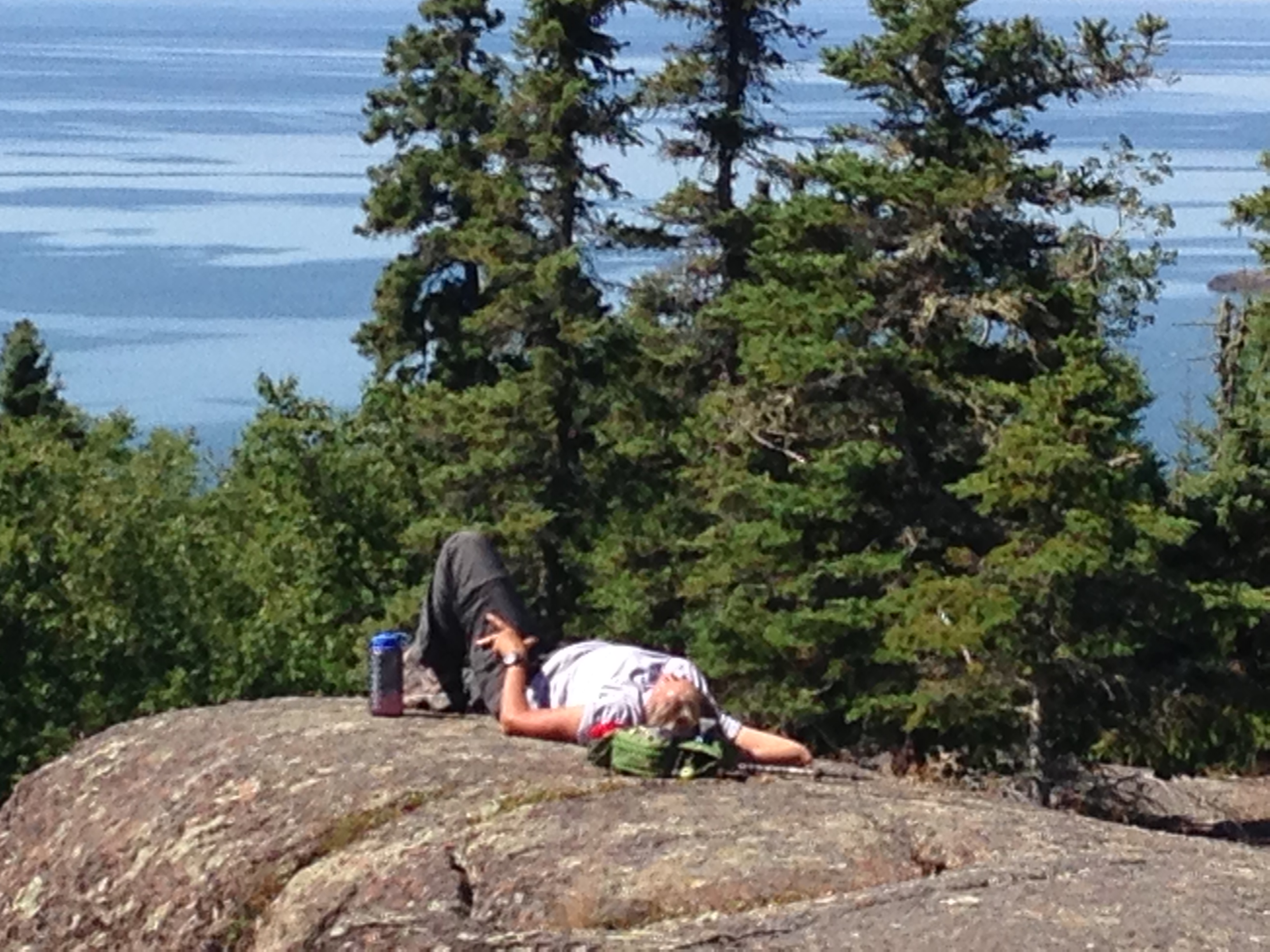
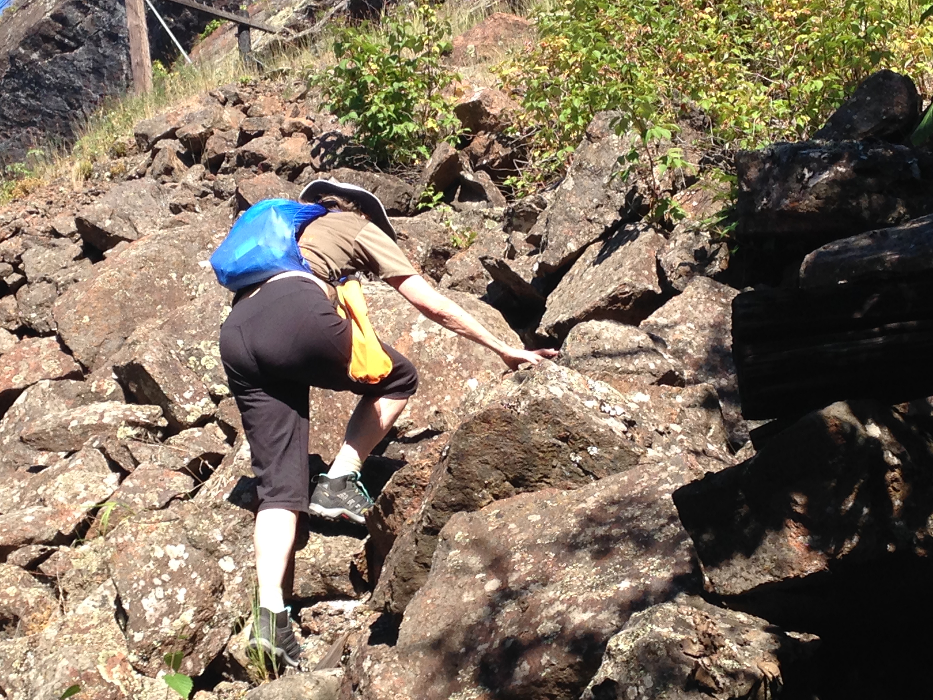
After a short snack, we opted to take the actual trail down, rather than attempting to make the steep descent back down into the Crack. The trail, while open, was also steep in sections and required some careful footing to remain safely on the trail. Eventually we found our way back to the train tracks, and a short bushwhack took us back to the boats where Awesome was waiting for the rest of us.
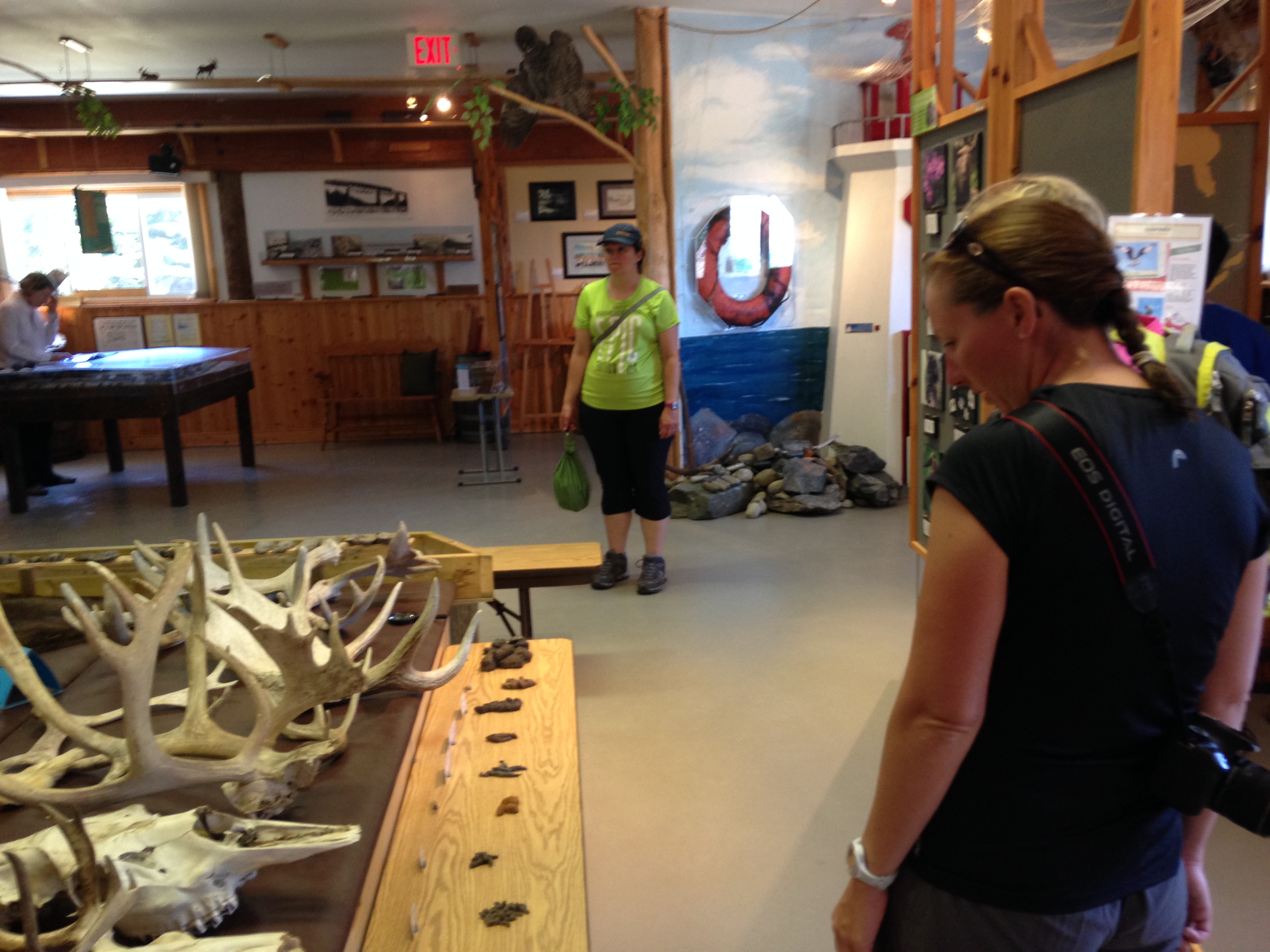
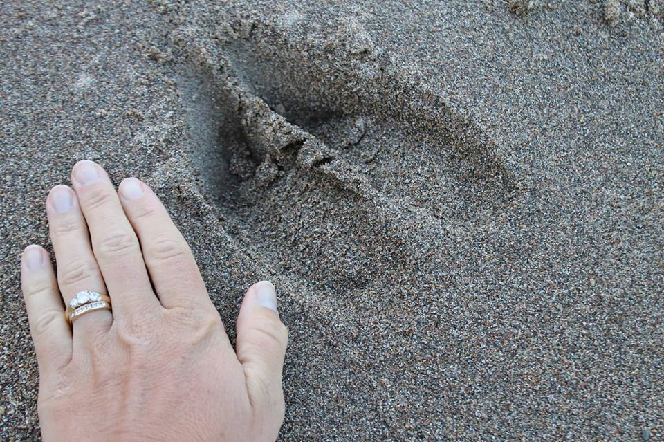
Once back in the boats, we ventured across to the other side of the river where we beached the craft at the boat launch. It was a couple mile hike to the Visitor’s Center of Neys Provincial Park along a paved road. Two-Point stayed behind with the boats to enjoy some solo time and rest her now aching back. The Visitor’s Center offered some interesting history about the park. The Park and surrounding islands were once used as a POW Camp for prisoners of World War II. Prisoners were treated very well and even had organized sports teams within the camp. Historic remains are scattered throughout the park. The Visitor’s Center also provided information on the wildlife and plants that can be found throughout the park. There was even an odd display of the different feces that one might find while in the park to help identify wildlife that may be nearby.
After lunch we made our way back to the boats, after of course making good use of the facilities. Amazing how excited one can get about using real flushing toilets! During our stop, Awesome managed to score some Canadian coins so that Pathfinder could purchase a cold Pepsi (hence earning her the nickname “Awesome”). Pathfinder was kind enough to share his cold beverage with everyone else. That one sip was extremely refreshing.
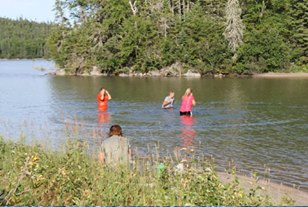
After returning to the boats, we made another long journey along the coast of Neys Provincial Park, through Thompson Channel and around Foster and Sullivan Islands. The Zodiac team scouted a few potential spots before deciding on a cove just east of Foster Island. Once again, we had found a perfect spot for camp for the night. The beach was littered with moose tracks, but alas no moose in sight. We each set up our tents in a row with a view of the cove. While Pathfinder, AR, and Reroute set out on the Zodiac to obtain a water sample (collecting water samples for a Micro-plastic Study conducted by Adventurers and Scientists), the rest of the group took advantage of the water. The water was crystal clear, slightly warmer than the water in other areas, and was smooth as glass. Much of the cove was only 2-3ft deep. Bones and Hot Pockets decided to walk across the water to the other side of the island and stumbled across a group of friendly kayakers who were also camping in the area. Neither group probably expected to encounter each other this deep in the wilderness.
When the Zodiac arrived, we all settled down around the campfire that Awesome had built practicing her Fire starter skills. As this was our last night together, we reminisced about the trip and our adventures, and laughed and told stories until late in the night.
Day Five (7/31/16) Marathon, Ontario, Canada
The following morning we awoke and travelled across Lake Superior to our starting point in Marathon, Ontario. We visited Keith McCuaig again to square up on the boat rental and share some of the stories about out exciting adventure. We then checked out a local restaurant and ate more food than we had probably eaten all week before bidding farewell to each other and heading our separate ways. I don’t think anyone could have asked for a more fantastic adventure. The weather was perfect, sunny and few clouds, the seas were mostly calm, and the people/teamwork was beyond one of the greatest. A fantastic adventure that took us farther!
We’d like to take a moment to give a special shout out to all of the members of the Islands of Illusion Expedition who help to make it a success:

Attending Members:
- Killer Bee (Robin Hutsko) – Expedition Leader
- Pathfinder (Chuck Hayden) – Assistant Expedition Leader / Captain Thor
- Spock (Mike Pemberton) – Captain MV Spock
- AR (Amy Colby) – Science Officer
- Selfie (Laurel Viewig) – Helmsman
- Knee High (Katie Pemberton)
- Awesome (Lisa Edwards)
- Re-route (Lark Burger)
- Two-Point (Julie Baskerville)
- Hot Pockets (Barb Carmichael)
- Bones (Pat Lamson)
And of course, a special thank you to our friends at McCuaig Marine for the use of the expedition boats as well as some great information on the area that helped in the planning of the expedition!