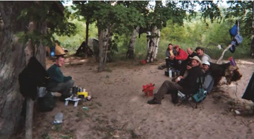
In August of 2003, the team crossed the Manitou Straits by kayak to explore the island and to develop their open water skills and protocol. Being August and the Great Lakes, storms were plentiful including the morning of August 21. That morning saw winds gust of 32 miles per hour and a small craft advisory that kept the Manitou Island Ferry delayed for a couple of hours. The team arrived just as the ferry finally arrived. This is the navigator’s story of the crossing.
Excerpt from Pathfinder’s Journal on the Manitou Strait’s Crossing
Thursday, August 21, 2003
3:28am I awoke to a fitful exhibit of flickering light through the nylon of my tent. A storm was moving in. Flashes appeared above the dunes. I ascended the dunes and saw a brilliant display of lightning over the expanse of open water. I descended back to camp and informed Papa (expedition leader) of the situation. We packed up camp in the calm atmosphere that only exists just before a storm. We finished just before the wind and driving rain. We slept in our vehicles until sunrise.
7:18 We awoke, the storm was gone, and chatted a bit. We went to Empire for breakfast.
8:23 Finished breakfast and headed for Glen Haven. Eight adventures present.
Chuck “Papa” Hill – Expedition Leader
Chuck “Pathfinder” Hayden – Expedition pathfinder
Bill “Wapiti” Smith – Researcher, Sweeper
Dane “Kramer” Proctor – Sweeper
Brian “Paddy” Hauenstein
Russ “Counselor” Cole
Quinton “Duck” Merrick
Vic Weeks – Inflatable Powerboat Skipper
9:15 With the kayaks and Inflatable packed and ready to launch, we gathered for a pre-crossing briefing. Kramer’s kayak drifted out as we were briefed. It was out of reach and drifting further. I kayaked out, secured the yak and towed it back.
9:23 Radio check with Wapiti, GPS operational (with full battery power), back up navigational equipment seems in good order. South Manitou was shrouded by mist and not visible. We launched.
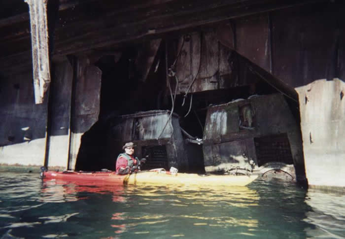
9:46 With three quarter’s of a mile down, we left the protection of Sleeping Bear Point. The wind was suddenly a strong 18 knots to our port side and the waves were about 4 feet. Everyone was asking themselves, “what the hell are we doing out here!?!” This is a common reaction to first entering rough open water. If everything goes well, this fear will soon subside. I noticed our sweeper, Wapiti, was falling behind with Duck. I radioed him and he reported that Duck was having trouble. Duck didn’t have a rudder and soon Wapiti removed his Red Wings flag from the stern of the kayak. Apparently, the flag acted like a stern sail and was forcing the stern to the starboard making him cock into the wind and progress very difficult. The wind and breaking waves were very loud and yelling to other expedition members was only possible for about 50 yards. Vic saw that we were handling things well and took the inflatable to the wreck of the Morazon.
10:11 My GPS (the only one operational at the time) beeped twice and shut down after we had passed 2 miles (last time I buy Duracell). The lighthouse on South Manitou was still not visible. I checked my compass and changed my heading to 340 degrees. It seemed that I had corrected a little more to port than was necessary, but I trusted the compass. It was difficult to keep the team on course because we tended (naturally) to turn into the wind and waves. The correct heading required that we take the seas almost directly on our port beam.
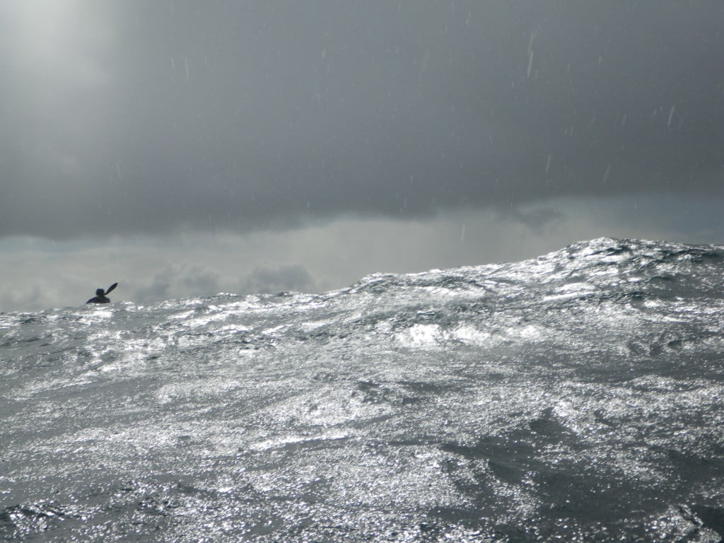
10:23 I took relative azimuths from the only two major land features I could see. I marked (as best I could) the intersection of those angles on the map and realized that we were probably drifting off course. I checked my compass and it showed that our heading was between 330 degrees and 350 degrees. I then noticed that the inoperable GPS was close enough to the compass to affect its magnetic function. When I pulled the GPS away the compass floated to around 300 degrees. We had to change course back even more to starboard. This made the wind and waves hit us on the port-stern making it even more difficult. I noticed the other yakers more than 100 yards away would disappear momentarily as the waves rolled toward me. I estimated the waves were reaching 5-6 feet. Duck was still having trouble. We would occasionally stop our progress to let him caught up. I seemed to miss Vic and his inflatable.
10:33 More than 3 miles down. The only two land features I could see have now disappeared and we were surrounded by steadily building waves and gray haze. I scanned for the South Manitou lighthouse, but only saw the ghostly gray haze. It almost suggested that nothing was out there. I checked my compass constantly. We were doing well in the rough seas, but the total reliance on a compass was eating at my confidence. I considered placing new batteries in the GPS, but the building seas instructed me to keep a firm grasp always on my paddle. My right leg had become completely numb. The loud wind and breaking waves made verbal communication difficult, even on the radio. At this point, I made a mental note to practice hand and arm signals.
10:46 As we approached (as best I could guess) about 4 miles, I noticed a tiny white tower deep in the distant cloud of haze. It was the size of a toothpick tip. THE LIGHTHOUSE! I felt an extreme sense of relief. And we were on a perfect heading for it. I reported this to the team and a few others confirmed the sighting.
11:14 Over 5 miles complete and our confidence is high. The waves continue to build. We can see the lighthouse keepers quarters and the shoreline now.
11:21 After hearing low rumbling in the distance, lightning streaks across the sky directly over the island. A huge rising thunderhead has presented itself over the island. The haze that blocked our view of the island also blocked our view of the thunder clouds.
11: 29 As the thunder continues, I am relieved of my duty as pathfinder and fall back with Duck and Wapiti. With around a mile and a half to go, the rest of the group now goes full speed to shore. I am now sweeping with Wapiti to help Duck, if needed. Because he has no rudder, his progress is very slow. He has to constantly back paddle to keep his craft on course. As Wapiti and I formed up to talk at a distance of 20 feet, he completely disappeared behind a wave. The waves seemed to be well over 6 feet.
12:08 We see people watching us from the walk on the lighthouse and walking on shore. Landing on shore by the lighthouse seems a little rough. The rest of the group has waited for us near shore and I resume my duties as pathfinder and direct the team to the American Flag flying to the north of the lighthouse. The flag usually marks the location of the ranger station. We enter the harbor and the water is immediately calm. The ferry rests at the dock and Vic is already there with his inflatable.

12:24 Crossing successful. We land our crafts and a huge clap of thunder cuts the sky open and a drenching rain sends us to anything near the dock that provides temporary shelter. All 8 souls accounted for and we are very proud and happy. We have accomplished what very few will even consider attempting. In all honesty, it wasn’t that bad, only because we had the proper equipment, experience and training. It was exciting, scary and difficult, but I think foolhardy would go too far.
Submitted by Pathfinder