Dates: August 17th -21st 2016
Location: East of Tunnel Lake and Wharncliffe area of Ontario, Canada.
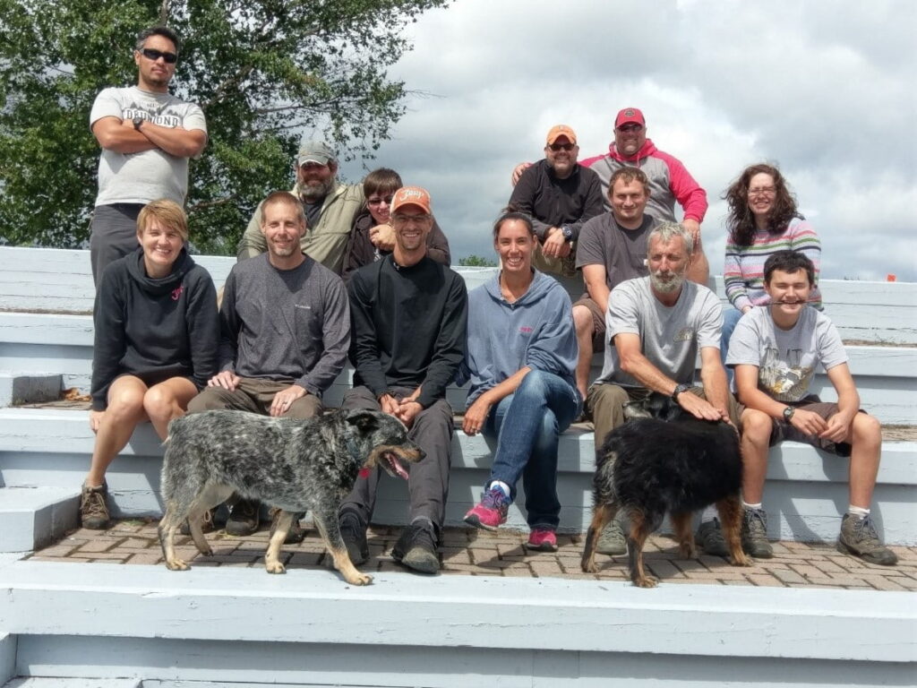
Team Members: 13 people
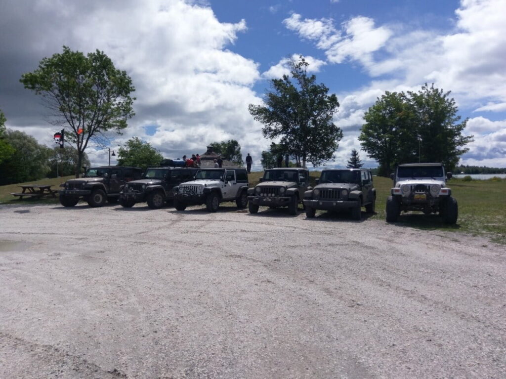
6 Jeep vehicles: 1 TJ, 2 JK’s, 3 JKU’s
Weather: highs 84, lows 65, some sun, rain, lightning, wind
Trails: ranged from narrow ATV to 2 lane logging roads. Sand, gravel, rock.
Wednesday:
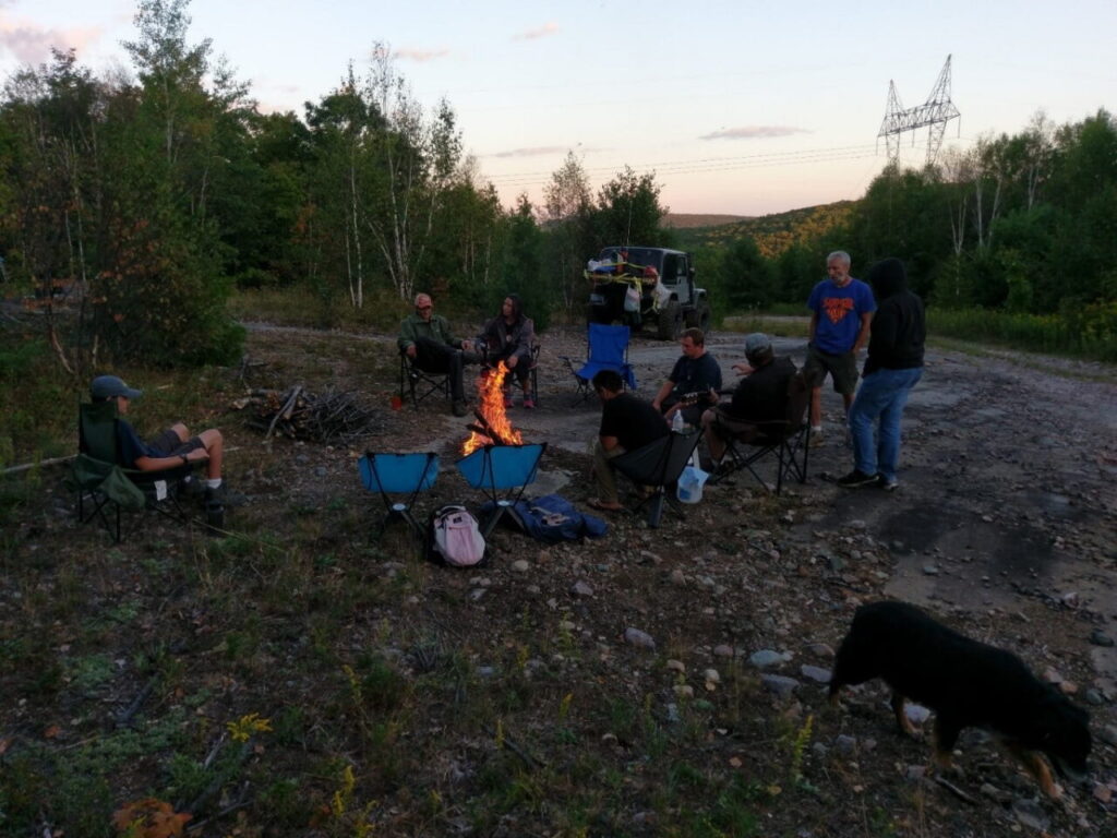
The team met up near Tunnel Lake Outfitters on 129. Great place for topping off the fuel tanks, grab some ice and last minute snacks. We immediately were met with rocky trails that led us up into the hills where we found a decent campsite near the top. The team setup camp, made some dinner, and got acquainted with each other. Many of us were friends and have spent much time with each other through other FBET trainings and expeditions. There were a few new faces but they fit in just great and we were confident that the next few days would hold enough adventure and challenges that we would be pulled together as a great team by the end. We had a warm evening, nearly full moon, and some good times around the campfire. Even a very short game of Duck, Duck, Goose (yep that just happened), and some good music.
Thursday:
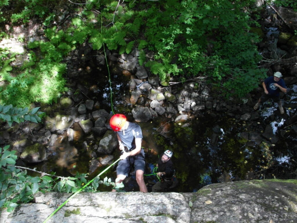
The team got packed up and headed out along a few miles of trail that had been previously scouted in the spring. The trail is barely wide enough for our vehicles and there are plenty of washouts and rocks to keep your attention while navigating the hills. We were following some main powerlines so there was not a lot of trees so that made for some good views. We also checked out one of the alternate routes into the area to check for a gate on private property. It is said that the owner locks the gate on Saturdays so this was part of why we were trying to find alternative trails into the area. More on that later. We moved on and decided to do some rope work with the team at a small waterfall about 50 yards into the woods off the trail. Many of the members did a short rappel down the first 10ft to the shelf and then the second wall of 30ft down to the bottom. They all did great and it was a fun way to spend some time. We checked out a cliff that might be a good place for future ice climbing training also. We moved on exploring a couple of dead end trails before heading to basecamp near the bottom of some of the area’s largest cliffs and the White River. Out came the tents and hammocks. It was quite warm so we decided to try and find a way down to the White River to see if we could cool off. We hiked down the ATV trail to the end and had to bushwhack the last 200 yards to the river’s edge. It was worth it! Cool and clear waters awaited with not a soul in sight. Back at camp we enjoyed another relaxing evening around the fire and some good food. About a hundred dragonflies circled our camp and seemed to keep the mosquitoes under control.
Friday:
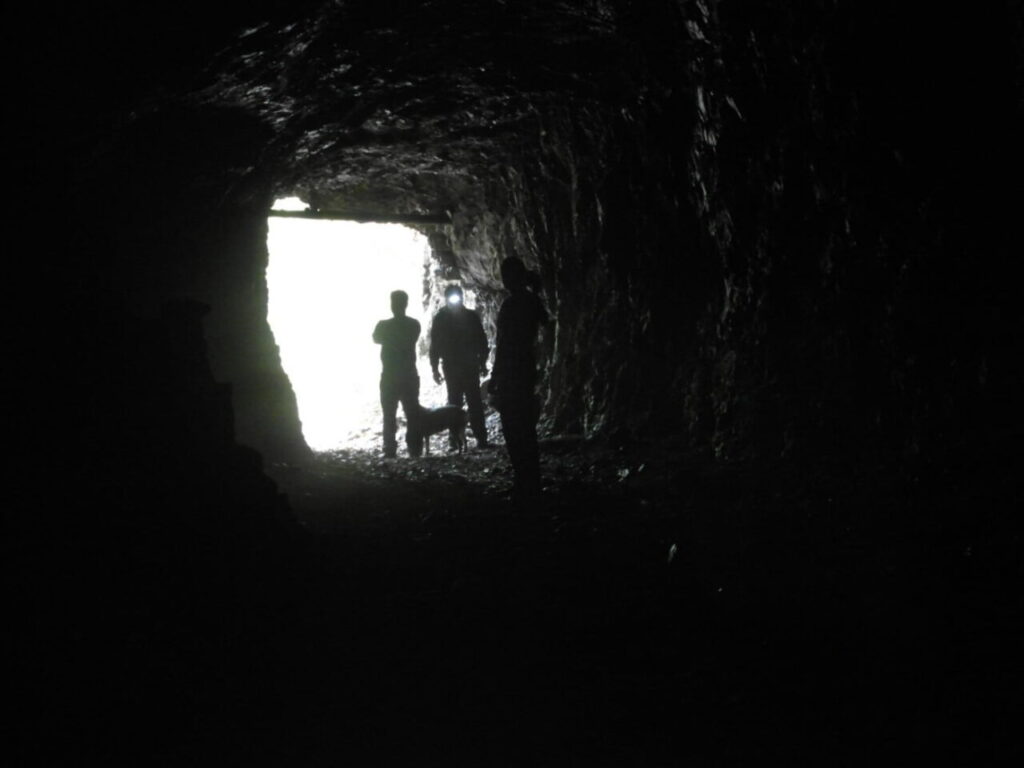
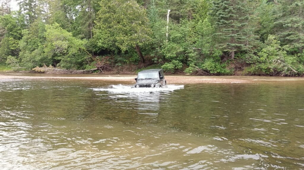
Since we were setup with a basecamp now, we could lighten the loads for traveling more technical trails. This days agenda included scouting a possible river crossing for a 3rd route into the area and to try to find a couple abandoned mines about an hour away. We made our way down the narrow trails lined by trees and bushes. We happened across a camp where many relics from the past were slowly being reclaimed by the wilderness. Stripped snowmobiles and pickup trucks form the 70’s were there. Just beyond that lay the White River. When you emerge from the woods and see the river straight in front you can see a short shelf of rock and sand before it drops off down to 20ft. Looking down river we can tell it is much shallower and worth walking across through the slow moving current to scout out a safe path to ford across in the vehicles. It looks to be safe and we give a short briefing of what we are going to do. One at a time the drivers follow the path over a short sandbar then to a gravel island through the water to the opposite shore. The deepest point looked to be around 32” to 36” deep. We were nervous and excited but everyone handled it and with that, we headed on to the mines. The first mine adit was quite large and went about 50 yards into the earth and very tall. The naturally cool air was like heaven on a hot day. We ate lunch and also enjoyed the views down on the lake. On to the next site. The second location had a couple abandoned adits and trench. One of these adits was deemed not safe by the leaders and the second was filled with water so there really wasn’t anymore to explore. It was nearing evening so we decided to attempt a trail that some said weren’t passable because of bad washouts. We managed to traverse the washouts fairly easily and thus adding another route into the area for future trips. And then the rain started. Since the rain really never let up we decided instead of just sitting there, we would test our skills and explore a bit more. Driving in the rain on narrow trails in the dark is always a good learning experience. We explored a couple short trails before moving out to check a trail we were going to tackle in the morning. This trail proved to be challenging. It was narrow with cut logs poking into the path hidden by leaves, darkness, and rain on the windshield. Let’s just say a few vehicles have some new scars or just think of them as stories. We found a spot just big enough to turn around after a half a mile and we headed back to camp around midnight.

Saturday:
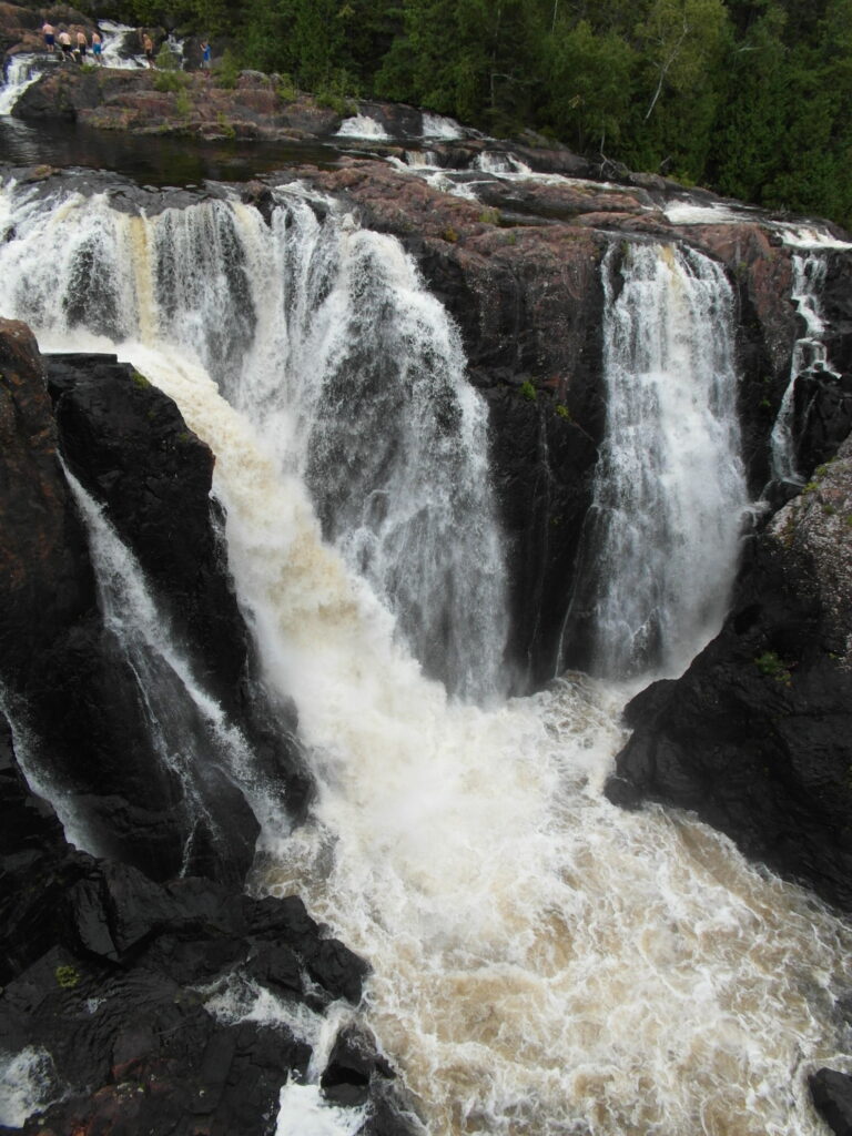
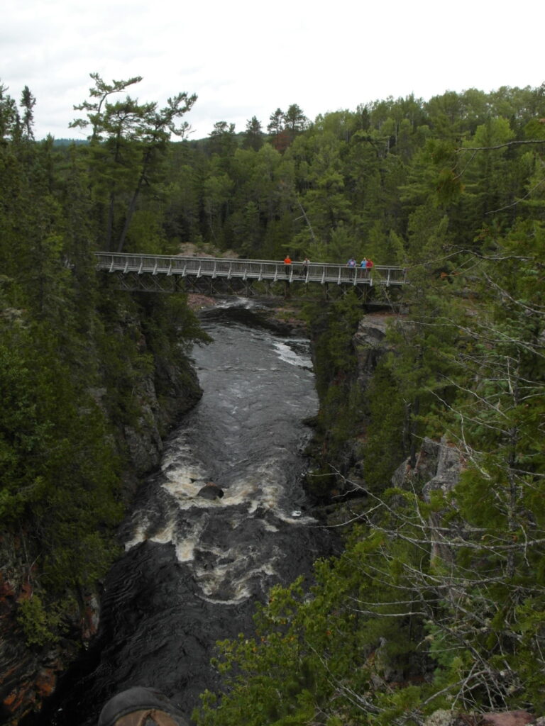
The team headed out looking for more exploration in the morning. We decided to drive along some of the more established trails. We located some nice lakes and a few small trails. One of which lead to a small river where the bridge was definitely built for an ATV or snowmobile, not the weight of a loaded overland vehicle so we turned around. Sometimes it’s not worth the risk. After about 50 miles of trails we arrived at Aubrey Falls to take in the sights. There is a short hike to get out the viewing area. The river cascades over the rocks in many places. Just below the falls the river takes a sharp right turn and runs through a deep gorge. There are several drops. The main drop is about 75 feet high. After the falls we headed back to camp along the main road. Ended up running across a fellow FBET Guild Member who has been camping in the area. He waved us down on the side of the road when he realized it was us. Pretty cool! By then it was raining and getting dark so we decided to try the washed out road entrance. The rain and wind picked up and a most of the group didn’t want to sit in a tent or vehicle. We ended up standing huddled together under a tarp and having a good time.
Sunday:
We decided to pack up and head to Bruce Mines for some breakfast. As the saying goes, we’re not out of the woods yet. We traveled about a quarter mile and came upon a downed tree that was blown down by the storm. The only trail out was blocked. The team pulled together and cleared the way with a chainsaw, an ax, and good old manpower. We moved on down the trail. Around one of the corners the leader saw a wolf jumping into the woods. We stopped and checked the tracks to confirm. We then travelled out of the area on the washed out trail just for a short challenge before heading back to civilization. We convoyed to Bobbers in Bruce Mines for some yummy breakfast, pictures, and goodbyes.
We’d like to thank our Overland Project partners at Courtesy Chrysler Dodge Ram Jeep for their support to make these trips possible. Also a huge thank you to our Jeep Technician Nate Baker who helps us out before, during, and after an expedition.
We enjoyed our adventures together and were left asking what’s next? When’s the next trip? Don’t worry, there will be more…
Jeremy Werner
Expedition Leader
Director of Overland Project
jwerner@fortunebay.org
Fortune Bay Expedition Team